
Places near here
Photo credits
- User:SeamusSweeney, Wikimedia Commons · CC BY-SA 3.0
- Christine Johnstone, Geograph · CC BY-SA 2.0
- Christine Johnstone, Geograph · Creative Commons Attribution-ShareAlike 2.0
- Albert Bridge, Geograph · CC BY-SA 2.0
- Aaron, Geograph · CC BY-SA 2.0
- Ardfern, Wikimedia Commons · CC BY-SA 3.0
- N Chadwick, Geograph · CC BY-SA 2.0
- Pulsar.co.nr, Wikimedia Commons · CC BY-SA 3.0
- Rossographer, Geograph · CC BY-SA 2.0
 Castle Espie Wetland CentreNature reserve · 529 yd
Explorer Tom Castle Espie puts Strangford Lough's birdlife close enough to make your binoculars feel like a backstage pass: follow…
 Brickworks; cf ihr 2781 in Castle EspieBrickworks · 661 yd
Explorer Tom Brickworks in Castle Espie used to be an industrial site full of Hoffmann kilns and smoke. Now it’s a nature reserve…
 Stone pier in Castle EspieStone Pier · 843 yd
Explorer Tom Stone pier in Castle Espie is on the western edge of Strangford Lough, built for brickworks that are gone. Its unlikely…
 Rough IslandIslet · 1682 yd
Explorer Tom Rough Island’s family tree is mostly made up, with generations of ancestors who were definitely real but also…
 Post-Medieval church & graveyard in TullynakillPost-Medieval church & graveyard · 2.0 mi
Explorer Tom Post-Medieval church & graveyard in Tullynakill has a thick wall on the north side. That’s not a coincidence, that’s a…
 Cistercian abbey (site of), now modern C of I church (c.f. hb 24/15/2) in Town Parks (comber)Cistercian abbey (site of), now modern C of I church (c.f. hb 24/15/2) · 2.1 mi
Explorer Tom This used to be a Cistercian abbey but now it’s just a modern church, so it’s like a grandpa who changed his haircut. A…
 Wood IslandIslet · 2.4 mi
Explorer Tom Wood Island in Strangford Lough is just sitting there looking smug about its old house ruins, probably daydreaming…
.JPG/250px-Mahee_Castle,_January_2011_(01).JPG "Photo: Ardfern, Wikimedia Commons · CC BY-SA 3.0") Mahee CastleCastle · 3.0 mi
Mahee CastleCastle · 3.0 miExplorer Tom Mahee Castle guards the north end of Mahee Island beside Strangford Lough, or would do if a ruined tower could still…
 Tower-house and bawn: mahee island in Mahee IslandTower-house and Bawn: Mahee Island · 3.0 mi
Explorer Tom Mahee Island in County Down is a tower-house that’s been hiding a scandal for centuries, probably involving a goat or a…
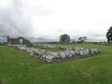 Nendrum monastic site in Mahee IslandNendrum Monastic Site · 3.2 mi
Explorer Tom Nendrum monastic site in Mahee Island is having a massive feud with that one big tree right next door. The monks wanted…
 Tardree ForestForest · 25 mi
Explorer Tom Tardree Forest is actually run by a very large dog who sits on the highest point and decides which conifers get to fall…
 CarnearnyMountain / peak · 25 mi
Explorer Tom Carnearny in County Antrim makes a weird groaning sound at night that locals swear is just the wind being dramatic.…
More archaeology and monuments in County Down · All of County Down

What do you know about this place?Tap to add a comment or ask a question