What is recorded here
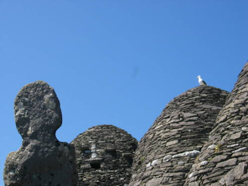
Structure described as a 'Leacht' in 1996 as follows; 'This is located to one side of the inner end of the entrance passage to the main terrace. Subrectangular in plan, 2.5m NWSE x 1.9m NESW, its sides are faced with horizontally laid slabs. There are three stone crosses [KE104A001095/096/097-] on its upper surface' (O'Sullivan and Sheehan 1996, 286, no. 948 (14)). Following excavations in this area it is considered that this is a structure dating from the time of the occupation of the island by lighthouse personnel in the early 19th century (pers. comm. G. Rourke).
Compiled by: Elizabeth Byrne, Ursula Egan and Sheila Ronan, Archaeological Survey Unit, University College, Cork.
Date of upload: 30 May 2011
The monument record does not grant public access. Check the route and ask the landowner before entering private land.
- What survives
- Recorded monument
Places near here
 Skellig MonasteryHeritage attraction · 9 yd
 Church (in Ruins)Church · 16 yd
 North PeakMountain / peak · 44 yd
 Cross in Sceilg MhichílCross · 122 yd
 Sceilig MhichílIslet · 143 yd
 Enclosure in Sceilg MhichílEnclosure · 186 yd
 Church in Sceilg MhichílChurch · 231 yd
 Sceilg MhíchílMountain / peak · 254 yd
 Pointe na bhFaoileannHeadland · 386 yd
 Sceilig BheagIslet · 1.5 mi
 LéimeHeadland · 6.8 mi
 Tráigh na SplinceBeach / strand · 8.6 mi