
Places near here
Photo credits
- National Inventory of Architectural Heritage
- N Chadwick, Wikimedia Commons · CC BY-SA 2.0
- Didier Descouens, Wikimedia Commons · CC BY-SA 4.0
- Richard Webb, Geograph · CC BY-SA 2.0
- Andreas F. Borchert, Wikimedia Commons · CC BY-SA 4.0
- Milesoneill, Wikimedia Commons · Public domain
- Florentchevallier, Wikimedia Commons · CC BY-SA 4.0
- Mike-kinsella, Wikimedia Commons · CC BY-SA 4.0
- Mick Garratt, Wikimedia Commons · CC BY-SA 2.0
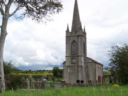 Killanly Church (Castleconor)Church/chapel · 310 yd
Explorer Tom Killanly Church in Castleconor would ace any job interview because it’s robust, simple, and never misses a deadline. It’d tell them it has great gatekeeping skills and a solid window-to-door ratio. Why this place matters is that it doesn’t need a resume to look impressive, mate.
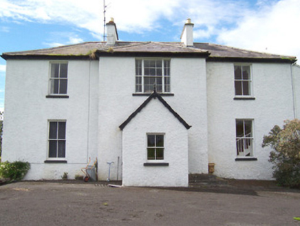 MoysdaleRectory/glebe/vicarage/curate's house · 473 yd
Explorer Tom Moysdale, the former rectory, once saw a vicar accidentally set the bow window slating on fire with a candle. It retains sash windows and curved slate details that survived that dramatic incident. Watch for any lingering smoke signals from the roofline today.
 Rosserk AbbeyVisitor attraction · 1466 yd
 Hawthorn1471 yd
Explorer Tom Hawthorn was used as a hiding spot for smugglers who were trying to sneak a case of whiskey through its branches. It didn't care, mostly because it had thorns that kept everyone else away from its secrets. Bring a pen pal, they'll be jealous.
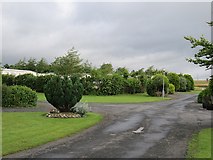 Belleek WoodsWood · 2.4 mi
 Moyne AbbeyHeritage attraction · 3.2 mi
 Humbert MonumentMemorial · 3.7 mi
 Wild Atlantic Way: Inishcrone PierVisitor information · 3.8 mi
Explorer Tom Inishcrone Pier looks like it’s plotting an escape plan, possibly because it’s tired of being just a sign for people who don’t read. The first owner probably ran off with the last ferry and never looked back at all. Bring a jacket, it's never as warm as I promise.
Battle of BallinaBattle · 3.9 mi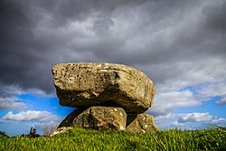 Dolmen of the four MaolsArchaeological place · 4.5 mi
 St. Patrick's CemeteryCemetery · 4.7 mi
Explorer Tom St. Patrick's Cemetery is bragging about surviving a storm so fierce it blew a cow into the sky, though I suspect that particular detail was added for dramatic effect later on. The grass is particularly green there, probably because the dead are watering it with their tears of joy at being remembered. A handy spot to stretch your legs and your imagination.
 Cathedral in Townplots WestCathedral · 5.0 mi
More archaeology and monuments in County Sligo · All of County Sligo

What do you know about this place?Tap to add a comment or ask a question