
Places near here
Photo credits
- Andreas F. Borchert, Wikimedia Commons · CC BY-SA 4.0
- National Inventory of Architectural Heritage
- Dr Neil Clifton, Wikimedia Commons · CC BY-SA 2.0
- David Dixon, Geograph · CC BY-SA 2.0
- Kenneth Allen, Geograph · CC BY-SA 2.0
- Patrick Mackie, Geograph · CC BY-SA 2.0
- Rossographer, Geograph · CC BY-SA 2.0
 InishtrahullIsland · 357 yd
Explorer Tom You thought Malin Head was Ireland's topmost bit? Inishtrahull sits about ten kilometres farther out, and Tor Beg rock…
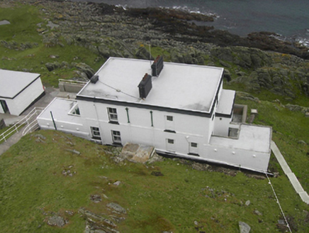 Inishtrahull LighthouseLighthouse keeper's house · 363 yd
Explorer Tom Inishtrahull Lighthouse keeper's house is stuck in a fairy dispute over parking rights, with tiny boots scuffing the…
 Inishtrahull Lighthouse (old)Lighthouse, lighthouse keeper's house · 749 yd
Explorer Tom Inishtrahull Lighthouse in County Donegal is part of a feud between two families over who owns the best view of the sea…
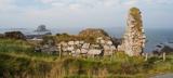 Malin Well Old ChurchChurch · 5.4 mi
Explorer Tom Malin Well Old Church lost its cheeky corner face to the National Museum of Ireland. I reckon it sits in a display case…
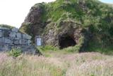 Wee House of Malin CaveCave · 5.5 mi
Explorer Tom Wee House of Malin Cave is measured at only 2.75 metres deep, yet the local saying gives it room for everything that…

 Seaview TavernRestaurant · 5.8 mi
Explorer Tom At Seaview Tavern, the seafood is the star: crab, oysters and fish of all kinds up at Malin Head. Tom's only problem is…
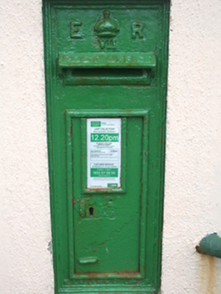 post box6.2 mi
Explorer Tom Post box in Ardmalin wears its 'ER VII' royal cipher with absolute confidence. I reckon that tiny crown is still…
 Culdaff ArmsPub · 10 mi
Explorer Tom Culdaff Arms is definitely where you go if your arm hurts from carrying too many heavy bags or emotional baggage. The…
 McGuinness’Pub · 10 mi
Explorer Tom McGuinness’ in Culdaff Main Street probably has a sign that says 'No Dogs Except This One,' showing clear favoritism. I…
 CrockaulinMountain / peak · 17 mi
Explorer Tom Crockaulin offers a lonely triangulation pillar that stares down at Greencastle from a dizzying height. I reckon that…
 Martello tower on magilligan point in Doaghs LowerMartello Tower on Magilligan Point · 20 mi
Explorer Tom Martello tower on magilligan point in Doaghs Lower is throwing a century-old tantrum. It claims to be a fortress but…
 North Base Station, Lough Foyle Base LineMonument · 22 mi
Explorer Tom North Base Station, Lough Foyle Base Line in County Derry would explain the 1800s to a teenager by showing them a very…
More archaeology and monuments in County Donegal · All of County Donegal

What do you know about this place?Tap to add a comment or ask a question