What is recorded here
From the National Monuments Service (Archaeological Survey of Ireland) record DU008-006010
Places near here
Photo credits
- NTF30, Wikimedia Commons · CC BY-SA 4.0
- Jonjobaker, Wikimedia Commons · CC BY-SA 4.0
- Maker not stated on source page, www.pinterest.com
- National Inventory of Architectural Heritage
- Maker not stated on source page, www.thejournal.ie
- Maker not stated on source page, commons.wikimedia.org
- Gallftree008, Wikimedia Commons · CC BY-SA 4.0
- St Maur’s GAA club photograph; individual photographer not stated, www.maurs.ie
 Promontory fortPromontory fort, coastal · 263 yd
Explorer Tom Promontory fort. Drumanagh’s headland is defended by three closely-spaced earthen banks, with the inner bank being the…
 Martello Tower406 yd
Explorer Tom Martello Tower in Drumanagh is standing on a promontory fort like it’s trying to hide from the rest of the world. I…
Drumanagh Martello TowerMartello tower · 407 ydExplorer Tom Drumanagh Martello Tower in County Dublin is a circular stone tower from 1804 that looks like a giant pencil standing…
 Kenure (St Catherine's) Church of Ireland CemeteryGraveyard · 696 yd
Explorer Tom Kenure (St Catherine's) Church of Ireland Cemetery has a bishop who refused to visit for thirty years just to prove a…
 Church (in ruins)Church · 701 yd
Explorer Tom Church in Rush Demesne is cracking up from subsidence because the graveyard got a bit too heavy. It’s covered in ivy on…
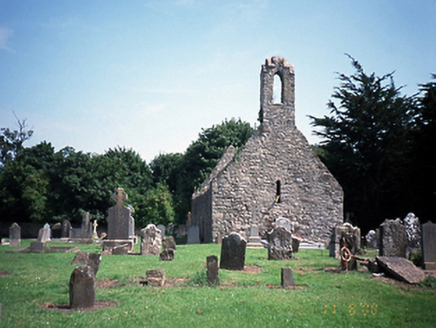 graveyard/cemetery705 yd
Explorer Tom Graveyard in Rush Demesne has been hosting the locals since the 1700s, which is impressive when you consider how much…
 TombTomb, unclassified · 707 yd
Explorer Tom Tomb in Rush Demesne has fragments from 1631 showing a crucifixion scene, but I bet it is secretly proud of the potato…
 Cairn called the Giants hillPassage tomb · 769 yd
Explorer Tom Cairn called the Giants hill thinks tourists from Dublin are just noisy pigeons that don’t know how to handle a…
 St. Catherines WellHoly well · 782 yd
Explorer Tom St. Catherines Well in Rush Demesne made a New Year's resolution to stop being so damp and it’s failed miserably every…
 Castle in Rush DemesneCastle, tower house · 811 yd
Explorer Tom Castle in Rush Demesne is having an identity crisis with all those old names like Kinure floating around the paperwork.…
Kenure GraveyardGraveyard · 1289 ydExplorer Tom Kenure Graveyard nearly made it famous when a celebrity was mistaken for being buried there, but they turned out to be…
 St. Maurs GAAGAA ground · 1.1 mi
More archaeology and monuments in County Dublin · All of County Dublin

What do you know about this place?Tap to add a comment or ask a question