What is recorded here
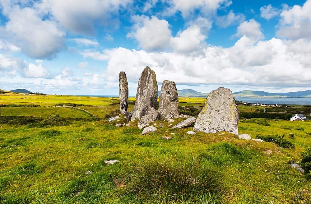
Three stones stand in a neat row on a western slope, forcing the winter solstice sun to set between them while a larger outlier watches from sixty metres away. The outlier carries cup marks and circles, proving that people still visited the rocks long after they first stood. A boulder-dolmen may have shared the plateau before a track took it, suggesting the row is the leftover edge of a bigger ceremonial place.
Situated on a generally W facing slope, commanding an extensive view over the Lispole valley and as far W as the Blasket Islands, this site is comprised of an alignment of 3 stones, 7.55m long, with an outlier standing 60m to NE.
The tallest stone, at the NE end of the line, stands 3m high and measures 1.7m x .4m at base. The middle stone, 1.38m further SW, is 2.2m high and 1.1m x .4m at base. The 3rd stone, 1.65m to SW again, is almost level with its neighbour and measures 1.3m x .5m at base. The alignment is orientated on the setting sun at the Winter Solstice (Lynch 1981b, 26).
The outlier stands 2.9m high and measures 2m x .58m at base; ENE-WSW. Its NW face bears a series of rock art motifs including a cup-and-2 circles centrally positioned on the face; below this are 2 cup-and-circles, and grouped together at the base of the stone are 2 cup-and-circles with radial lines, and a cup-and-incomplete circle. In addition there are 7 plain cup-marks and a series of linear grooves (the dotted lines on the drawing represent uncertain markings).
Immediately NW of this stone, a large boulder resting on 3 smaller ones was removed to make way for a track (local information). Based on the description and the context it is suggested that this feature was a boulder-dolmen; it is not unusual for such monuments to occur in close proximity to isolated or pairs of standing stones, although none have previously been recorded in association with a stone alignment (Ó Nualláin 1978a, 75-114).
See attached screenshots of 3D model of the rock art panel created by The Discovery Programme. 3D model can be accessed at the following website: https://skfb.ly/XQv9
The above description is derived from J. Cuppage, ‘Corca Dhuibhne. Dingle Peninsula archaeological survey. Ballyferriter. Oidhreacht Chorca Dhuibhne’ (1986), no. 50. In certain instances the entries have been revised and updated in the light of recent research.
Date of upload: 3 August 2013
The monument record does not grant public access. Check the route and ask the landowner before entering private land.
- What survives
- Recorded monument
Places near here
 Ardamore Stone RowArchaeological place · 175 yd
 Wedge tomb in Dún Na ManachWedge tomb · 736 yd
 Lispole Ambush MonumentWayside cross · 1102 yd
 Séipéal Eoin Baiste [Catholic Church of Saint John the Baptist]church/chapel · 1156 yd
 Country house in Arda Mór (tc Cinn Aird)Country house · 1239 yd
 CarrigavinnaunNamed rock · 1.6 mi
 Cnoc an GhleannaMountain / peak · 1.8 mi
 Tobar EoinSpring · 2.0 mi
 Caisleán na Mine AirdeCastle · 2.1 mi
 Minard Castle (in ruins)Castle, tower house · 2.1 mi
 Cruach SceirdeMountain / peak · 2.5 mi
 Acres PointHeadland · 2.8 mi