What is recorded here
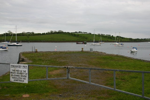
Stone quay in Ringhaddy is a stone quay in County Down, Ireland.
From the Northern Ireland Sites and Monuments Record record MRD187:108
The monument record does not grant public access. Check the route and ask the landowner before entering private land.
- What survives
- Recorded monument
Places near here
 Stone quay in BallymorranStone Quay · 1.4 mi
 Conly IslandIslet · 1.5 mi
 Island TaggartIslet · 2.3 mi
 Sketrick Castle (ruin)Castle · 2.6 mi
 Tower-house, bawn & passage to spring: sketrick castle in Sketrick IslandTower-house, Bawn & Passage to Spring: Sketrick Castle · 2.6 mi
 ShrigleyVisitor information · 3.1 mi
 Net Walk & Shore LoneyWalking route · 3.3 mi
 Killowen medieval church (ruined) and graveyard; with 2 cross-carved stones in Corporation (killyleagh)Killowen Medieval Church (ruined) and Graveyard · 3.3 mi
 Nendrum monastic site in Mahee IslandNendrum Monastic Site · 3.3 mi
 The Round TowerVisitor information · 3.3 mi
_-_geograph.org.uk_-_3438577.jpg/250px-Killyleagh_Castle_(2013)_-_geograph.org.uk_-_3438577.jpg "Photo: Albert Bridge, Wikimedia Commons · CC BY-SA 2.0") Killyleagh CastleCountry House · 3.5 mi
Killyleagh CastleCountry House · 3.5 mi Dufferin ArmsPublic House · 3.5 mi
Pictures: Bob Jones, Geograph · Creative Commons Attribution-ShareAlike 2.0; Anne Burgess, Geograph · CC BY-SA 2.0; Rossographer, Geograph · CC BY-SA 2.0; N Chadwick, Geograph · CC BY-SA 2.0; Albert Bridge, Geograph · CC BY-SA 2.0; Albert Bridge, Geograph · Creative Commons Attribution-ShareAlike 2.0; Pulsar.co.nr, Wikimedia Commons · CC BY-SA 3.0; Albert Bridge, Wikimedia Commons · CC BY-SA 2.0; Eric Jones, Wikimedia Commons · CC BY-SA 2.0
More archaeology and monuments in County Down · All of County Down
What do you know about this place?