
What is recorded here
The ruins of a simple church (DG002-002001-) stand by the shore at the base of a cliff on the N side of Malin Head. A rude face carved on the top stone of the corner between the S wall and the E gable (DA 1953-4, 503), is now in the National Museum of Ireland (Reg. No. 1972:5). This consists of a rectangular block of…
Read the whole record
From the National Monuments Service (Archaeological Survey of Ireland) record DG002-002004
Places near here
Photo credits
- Andreas F. Borchert, Wikimedia Commons · CC BY-SA 4.0
- Dr Neil Clifton, Wikimedia Commons · CC BY-SA 2.0
- David Dixon, Geograph · CC BY-SA 2.0
- National Inventory of Architectural Heritage
- Dr Neil Clifton, Geograph · CC BY-SA 2.0
- Maker not stated on source page, www.minube.co.uk
- Maker not stated on source page, ru.needles-and-wool.com
- Maker not stated on source page, www.youtube.com
- Corinna Schleiffer, Geograph Ireland via Wikimedia Commons
- Kenneth Allen, Wikimedia Commons
- Donegal Daily; photographer not named, Source publisher
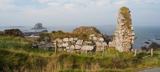 Malin Well Old ChurchChurch · 4 yd
Explorer Tom Malin Well Old Church lost its cheeky corner face to the National Museum of Ireland. I reckon it sits in a display case…
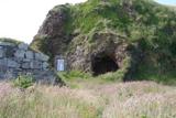 Wee House of Malin CaveCave · 31 yd
Explorer Tom Wee House of Malin Cave is measured at only 2.75 metres deep, yet the local saying gives it room for everything that…

 Seaview TavernRestaurant · 926 yd
Explorer Tom At Seaview Tavern, the seafood is the star: crab, oysters and fish of all kinds up at Malin Head. Tom's only problem is…
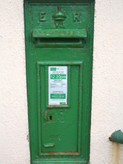 post box1513 yd
Explorer Tom Post box in Ardmalin wears its 'ER VII' royal cipher with absolute confidence. I reckon that tiny crown is still…
 White StrandGuesthouse · 1.3 mi
Explorer Tom White Strand is probably white because it hasn't been cleaned since 1954, or maybe it’s just naturally that pristine.…
 Kilmurray Burial GroundBurial ground · 1.6 mi
Explorer Tom Kilmurray Burial Ground is just a modern field clearance cairn on a slight ridge, though locals swear it’s sitting…
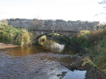 Keenagh BridgeBridge · 1.6 mi
Explorer Tom Keenagh Bridge has been spanning the river with a single limestone arch since c. 1860, its rock-faced voussoirs showing…
 Pebble StrandBeach / strand · 1.9 mi
Explorer Tom Pebble Strand at Malin Head is an honest name: the stones are the main characters, and the Atlantic keeps rearranging…
 Destroyed Ardmalin Children's Burial GroundChildren's burial ground · 2.1 mi
Explorer Tom Destroyed Ardmalin Children's Burial Ground used to be a raised patch between pebbles and sand, but quarrying bulldozed…
 Doagh Famine VillageMuseum · 4.1 mi
Explorer Tom Doagh Famine Village tells this coast's history through homes, voices and a guided tour. The original thatched…
 Pollan BaySurfing beach · 5.2 mi
Explorer Tom Pollan Strand runs from Ballyliffin towards the Isle of Doagh, with Glashedy Island offshore and waves that give…
 Connolly Park, MalinGAA ground · 5.3 mi
Explorer Tom Connolly Park is Malin’s proud patch of Gaelic games, up near the tip of Inishowen where an away team has already had…
More archaeology and monuments in County Donegal · All of County Donegal

What do you know about this place?Tap to add a comment or ask a question