
What is recorded here
National monument No. 247. Situated on slightly elevated grassland 370m W of Lough Gur and surrounded by a cluster of prehistoric monuments. Standing stones (LI032-009----/010002-) 147m and 210m to NNW, a trackway running NW-SE known as Cladh na Leac (LI032-010001-) 180m to E, large embanked stone circle (LI032-004001----) 90m to S, levelled stone circle (LI032-005----) immediately to SSW, standing stone known as Cloch á Bhíle (LI032-007----) 200m to SSE, site of Giant's Grave (LI032-010003-) possibly a megalithic structure 340m to SSE, site of a possible megalithic tomb/portal tomb (LI032-004002-) 160m to SSW, a trapezoidal setting of stones (LI032-002----) annotated as a 'Stone Avenue' which may be remains of a court tomb (Cooney and Grogan 1994, 64-5; Cleary 2015, 51) standing beside a levelled embanked stone circle (LI032-003---) 130m to W.
Present remains consist of a slightly raised circular shaped area (diam. 17m) which may be the remains of a denuded mound enclosed by fifteen low orthostats of varying shapes with a wide gap at SSW and slight traces of an external bank. The presence of an outlying recumbent stone a few yards E of circle no longer survives. It has been suggested that the gap at SSW was created by the removal of two orthostats (O'Kelly and O'Kelly 1978, 13). Aerial photographs taken in 1966 show the stone circle enclosing a low central mound with the remains of an enclosing bank also visible (CUCAP APC076/077/078)
The small stone circle with an outlying recumbent stone to E but now removed was described in 1826 as ‘a third, which is but seventeen yards in diameter, and composed of fifteen large rocks standing erect. A few yards to the E of these is a large stone lying flat, seven feet and a half [2.2m] in length, six [1.8m] in height, and four and a half [1.3m] in breadth, which is generally supposed to have been the altar for sacrifice’ (Fitzgerald and McGregor 1826, 298). In 1840 the Ordnance Survey letters described the monument as following; ’On the north-east stands smallest, forty-five [14m] in diameter. A perfect circle formed of stones of large size, placed at intervals, all from four to five feet [1.2-1.5m] high, and several of them with squared flat tops’ (OSL 1840, 249).
To see a 3D model of this monument, visit: https://skfb.ly/osXDA
Compiled by: Caimin O'Brien
Date of upload: 19 May 2018
Probably dating to the Late Neolithic or Bronze Age, this stone circle is likely associated with ritual or ceremonial activity, possibly linked to the broader ritual landscape of Lough Gur. Its placement among other monuments suggests it may have been part of a wider network with astronomical or social significance.
The monument record does not grant public access. Check the route and ask the landowner before entering private land.
- What survives
- Recorded monument
Places near here
 Stone CirclesStone circle, embanked · 138 yd
 Grange Stone CircleArchaeological place · 141 yd
 Lough GurVisitor information · 154 yd
 Structure in Grange (smallcounty By.)Structure · 156 yd
 Cladh na LeacRoad, road/trackway · 260 yd
 Bawn in Grange (smallcounty By.)Bawn · 502 yd
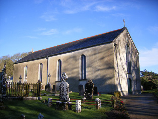 Catholic Church of Saint Patrick and Saint Brigidchurch/chapel · 572 yd
 Garret IslandCastle, unclassified · 735 yd
 Pedunculate OakPedunculate Oak · 1605 yd
 The SpectaclesVisitor information · 1.0 mi
 Lough Gur Heritage CentreVisitor information · 1.0 mi
 Glen BogForest · 2.2 mi
Other information
Photo: David Hawgood · CC BY-SA 2.0