What is recorded here
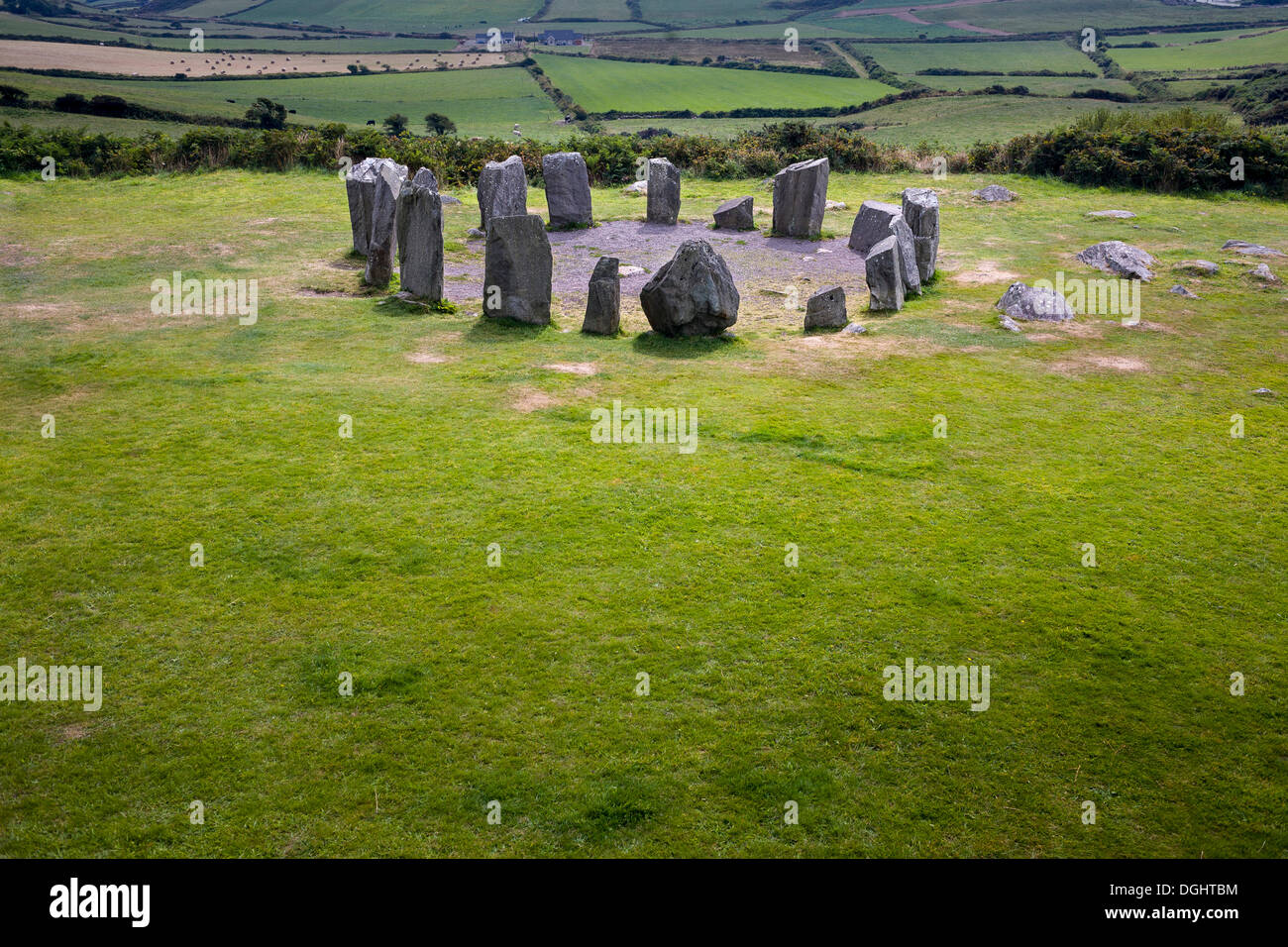
Eight stones circle a small patch of rocky bogland beside a Caha river tributary, marking a place where the boundary between human intention and mountain chance remains unclear. A shallow ditch runs just inside the stones, and a quartz block sits buried in the fence line to the south, as if the circle had grown into the land rather than being placed upon it. The precision is there, but the purpose is not.
On small level patch of rocky mountain bogland, on S-facing tributary of Caha river. Circle of eight orthostats, delimiting area 8.5m in diameter. Immediately within circle is fosse (D c. 0.5m; Wth 1m - 2m). Enclosed area level, contains three recent pits. Base of fence abuts circle to S; incorporated in this, 2m to S, is quartz block. Precise nature of monument unclear; no certain entrance stones or axial stones can be identified. (Ó Nualláin 1984, 17, no. 18)
The above description is derived from the published 'Archaeological Inventory of County Cork. Volume 1: West Cork' (Dublin: Stationery Office, 1992). In certain instances the entries have been revised and updated in the light of recent research.
Date of upload/revision: 14 January 2009
Probably dating to the Late Neolithic or Early Bronze Age, this stone circle may have had ceremonial or ritual significance, possibly linked to astronomical observations or seasonal festivals. The presence of a fosse suggests it could have been part of a more complex ritual landscape or used for symbolic boundary-marking.
The monument record does not grant public access. Check the route and ask the landowner before entering private land.
- What survives
- Recorded monument
Places near here
 KilnKiln, lime · 731 yd
 Windmill in CurradrinaghWindmill · 1059 yd
 AltarMass-rock · 1175 yd
 IndicatedChurch · 1439 yd
 Kilmichael Ambushambush · 1.6 mi
 OCrowleys Castle (in Ruins)Castle, tower house · 1.6 mi
 Kilmichael Ambush SiteMonument · 1.6 mi
 Funmanway Adventure LandHeritage attraction · 3.6 mi
 Gortnahoughtee Mass RockNamed rock · 3.7 mi
 Mount GunneryMountain / peak · 3.8 mi
 Carrignacurra CastleCastle · 3.9 mi
 Castle RockNamed rock · 4.2 mi