What is recorded here
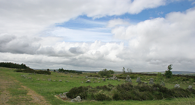
The official Northern Ireland record identifies this as STONE ALIGNMENT AND 2 PRE-BOG CLEARANCE CAIRNS. Recorded period: PREHISTORIC. The official map point was placed at the centre of the recorded archaeological site from the source map reference.
Prehistoric stone alignment and pre-bog clearance cairns; likely dating to the Neolithic or Bronze Age. These features are significant as they reflect early land use and ritual practices in a now altered landscape due to peat extraction.
The monument record does not grant public access. Check the route and ask the landowner before entering private land.
- What survives
- Recorded monument
Places near here
 CAIRNS & ?ENCLOSURE in BroughdergCAIRNS & ?ENCLOSURE · 66 yd
 Evishessan BridgeBridge · 1036 yd
 Formil WoodForest · 1.2 mi
 D-SHAPED ENCLOSURE in CrouckD-SHAPED ENCLOSURE · 1.7 mi
 Beaghmore Stone CirclesVisitor information · 1.8 mi
 BeaghmoreArchaeological place · 1.8 mi
 Cashel WoodForest · 2.2 mi
 OughtmoreMountain / peak · 4.3 mi
 CrocknamoghilMountain / peak · 4.8 mi
 St. Mary's ChurchChurch · 6.7 mi
 Lough FeaWalking route · 6.7 mi
 GRAVEYARD: RELIGNAMAN or RELICKNAMAN from RELIG NA MBAN The Women's' Graveyard in CarrickmoreGRAVEYARD: RELIGNAMAN or RELICKNAMAN from RELIG NA MBAN The Women's' Graveyard · 8.0 mi