
What is recorded here
Stirling, Mote Hill is a fort in Stirling, Scotland.
From the Historic Environment Scotland record 46206
The historic-place record does not grant public access. Check current conditions and ownership before entering land or a building.
Places near here
 Mote HillMountain / peak · 6 yd
 Beheading StoneHeritage attraction · 16 yd
 Stirling, Gowan HillEnclosure, Rig and Furrow (medieval) - (post Medieval) · 233 yd
 Stirling, Old BridgeBuilding (19th Century), Wall(s) (19th Century) · 305 yd
 Gowan HillMountain / peak · 351 yd
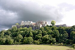 Siege of Stirling CastleSiege · 384 yd
 Stirling, Causewayhead, Bridgehaugh Road, Old BridgeRoad Bridge (15th Century) · 417 yd
 Stirling, 14 Lower CastlehillCoin (roman) · 497 yd
 Robert the Bruce MonumentMemorial · 576 yd
 Battle of StirlingBattle · 603 yd
 Stirling CastleCastle (medieval), Midden, War Memorial(s) (20th Century) · 626 yd
 Stirling, Valley Cemetery, James Guthrie's MonumentCommemorative Monument · 791 yd
Pictures: Euan Nelson, Wikimedia Commons · CC BY-SA 2.0; Lairich Rig, Wikimedia Commons · CC BY-SA 2.0; Ian S, Wikimedia Commons · CC BY-SA 2.0; LeCardinal, Wikimedia Commons · CC BY-SA 3.0; Bartolo Creations, Wikimedia Commons · CC BY-SA 2.0; Andrew Abbott, Wikimedia Commons · CC BY-SA 2.0; David Dixon, Wikimedia Commons · CC BY-SA 2.0; Maker shown on the Wikimedia Commons file page · CC BY-SA 3.0; John McPake, Wikimedia Commons · CC BY 2.0; Anthony Parkes, Wikimedia Commons · CC BY-SA 2.0
More archaeology and monuments in Stirling · All of Stirling
What do you know about this place?