
What is recorded here
From the National Monuments Service (Archaeological Survey of Ireland) record DG004-021
Places near here
Photo credits
- Maker not stated on source page, commons.wikimedia.org
- Wanfried-Dublin, Wikimedia Commons · CC BY-SA 4.0
- National Inventory of Architectural Heritage
- Golfing in Ireland; photographer not stated, Source publisher
- Maker not stated on source page, golfparexcellence.com
- Kenneth Allen, Geograph · CC BY-SA 2.0
- Caroline McLaughlin / Donegal Live, Source publisher
- Carroll Pierce, Wikimedia Commons
- Maker not stated on source page, www.tuatha.ie
- Andreas F. Borchert, Wikimedia Commons · CC BY-SA 4.0
- Picture: Barrack Hill Town Park
 Standing stone in Carrowreagh or CraignacallyStanding stone · 1123 yd
Explorer Tom Standing stone in Carrowreagh Or Craignacally is a low upright just 14m south of a rock art panel. Van Hoek noted in…
 Magheranaul Wedge TombWedge tomb · 1349 yd
Explorer Tom Magheranaul Wedge Tomb has a single roofstone covering its gallery, with an hour-glass hole bored right through the…
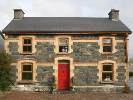 railway station1.6 mi
Explorer Tom This railway station in Rashenny is dressed up in a gorgeous clash of dark stone and bright yellow brick. It served the…
 Ballyliffin Golf ClubGolf course · 1.7 mi
 Ballyliffin Golf Club RestaurantRestaurant · 1.8 mi
Explorer Tom Ballyliffin Golf Club Restaurant is where golfers eat after losing their balls in the bushes and feeling a bit…
 Nancy's BarnCafé · 2.8 mi
Explorer Tom Nancy's Barn serves fish that looks like it hasn't moved since the Ice Age. It would complain to the council about the…
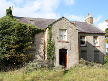 Donagh Church of Ireland RectoryRectory/glebe/vicarage/curate's house · 2.8 mi
Explorer Tom Donagh Church of Ireland Rectory is a c. 1776 beauty that’s basically sleeping in its own garden. Look at those ashlar…
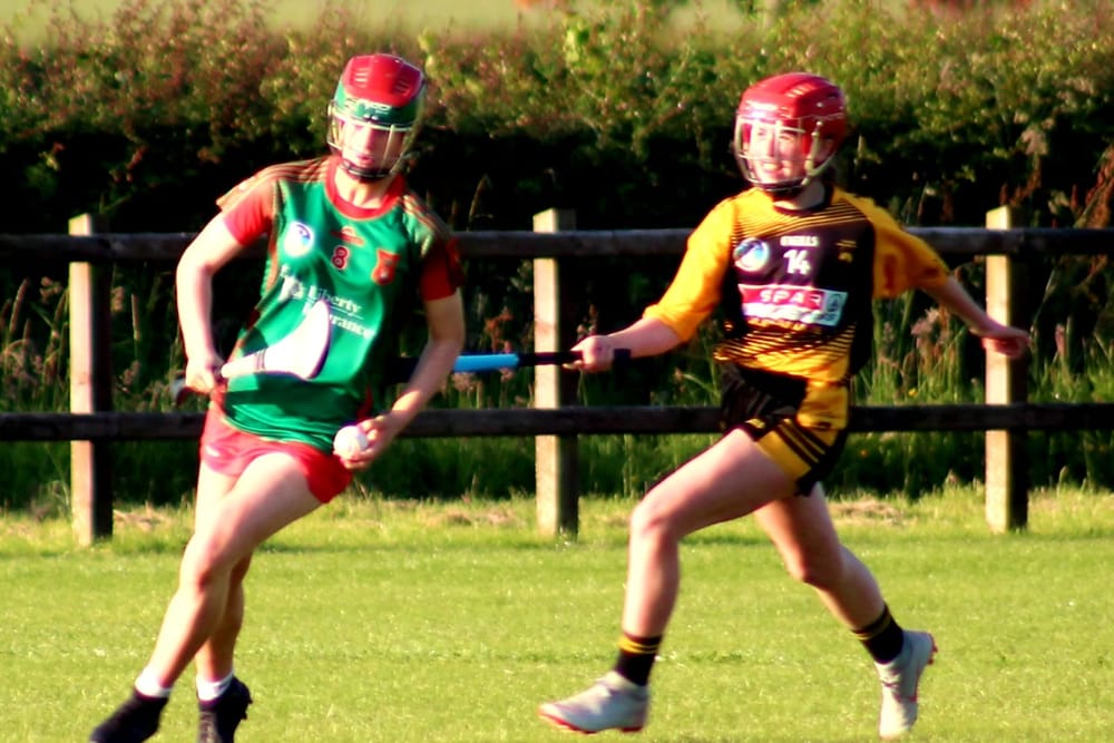 Páirc O’Dochartaigh, CarndonaghGAA ground · 4.5 mi
Explorer Tom Páirc O’Dochartaigh is Carndonagh’s Gaelic games home at Foden, where football, hurling and camogie have all found room…
 Tullagh BaySurfing beach · 4.5 mi
Explorer Tom Tullagh Bay curves below Binion Hill like someone drew a horseshoe in the sand and forgot to stop. Surfers know its…
 CastleCastle, unclassified · 4.6 mi
Explorer Tom A castle stood beside the church at Straid in 1600, perhaps a stone house occupied by a priest named Amerson. Its exact…
 Clonmany Early Church GraveyardGraveyard · 4.6 mi
Explorer Tom Clonmany Early Church Graveyard hides a stone with two cupmarks called St. Colmcille's knee-prints. I reckon a kneeling…
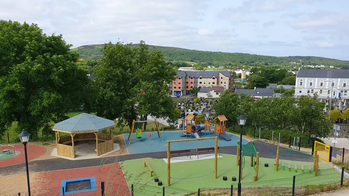 Barrack Hill Town Park PlaygroundChildren's playground · 4.6 mi
Explorer Tom At Barrack Hill, little legs get the climbing frames, swings, balance beams and monkey bars. The roundabout was…
More archaeology and monuments in County Donegal · All of County Donegal

What do you know about this place?Tap to add a comment or ask a question