
What is recorded here
From the National Monuments Service (Archaeological Survey of Ireland) record KE067-111
Places near here
Photo credits
- Maker not stated on source page, www.dreamstime.com
- Maker not stated on source page, www.agriland.ie
- Maker not stated on source page, cz.pinterest.com
- Maker not stated on source page, en.wikipedia.org
- Maker not stated on source page, ru.pinterest.com
- Maker not stated on source page, za.pinterest.com
- Maker not stated on source page, www.wildernessireland.com
- Kmcnamee, Wikimedia Commons · CC BY-SA 4.0
- Maker not stated on source page, www.irelandhighlights.com
- Maker not stated on source page, www.geograph.ie
- Maker not stated on source page, www.gpsmycity.com
 Megalithic structure in LisbabeMegalithic structure · 1374 yd
Explorer Tom Megalithic structure in Lisbabe is what happens when huge slabs decide to play Jenga with gravity and win by doing…
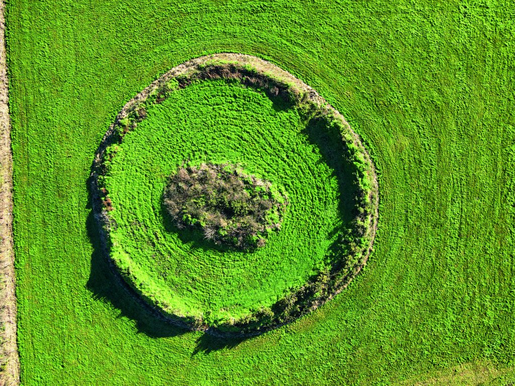 Fairy fort / earthen ringfort in LisbabeFairy fort / earthen ringfort · 1566 yd
Explorer Tom A massive double-banked fort in Lisbabe. The shortcut is definitely not a shortcut; it’s just a ditch. It’s got a wide…
 Standing stone in CarrigeenculliaStanding stone · 1.6 mi
Explorer Tom Standing stone in Carrigeencullia is chatting with its unlikely celebrity friend, The Paps of Dana. It’s got the view…
 Mapped graveyardGraveyard · 1.7 mi
Explorer Tom The drama between this mapped graveyard in County Kerry and the nearest tree is intense; they're constantly fighting…
 Stone circleStone circle, multiple-stone · 1.9 mi
Explorer Tom Stone circle in Readrinagh has an imaginary twin across the sea, but it's too shy to say hello or even wave properly.…
 Fairy fort / earthen ringfort in CarrigeenculliaFairy fort / earthen ringfort · 1.9 mi
Explorer Tom Fairy fort / earthen ringfort in Carrigeencullia has a bird that refuses to leave its entrance, claiming it’s a VIP…
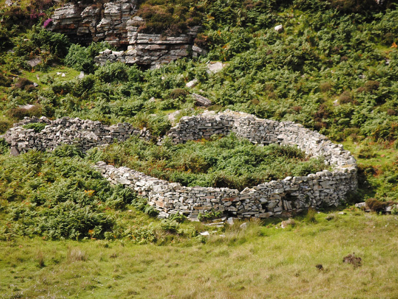 Fairy fort / earthen ringfort in KnockdoorahFairy fort / earthen ringfort · 2.0 mi
Explorer Tom Fairy fort / earthen ringfort in Knockdoorah started because two lads made a bet in the pub about who could dig a hole…
Fairy fort / earthen ringfort in Kilquane (magunihy By.)Fairy fort / earthen ringfort · 2.4 miExplorer Tom Kilquane’s fairy fort was once thought to be a kids’ graveyard, which is tragic. It’s basically a patch of ground with…
 Glenflesk GAA pitchGAA ground · 4.4 mi
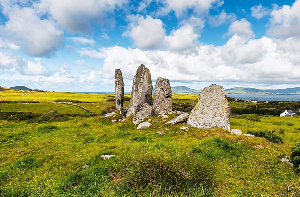 Standing stone in Annagh BegStanding stone · 4.8 mi
Explorer Tom Standing stone in Annagh Beg is jealous it doesn’t have a proper name like its famous cousin down the road. It just…
 Flesk CastleCountry house · 5.2 mi
Explorer Tom Flesk Castle was built by a man who thought he could paint rubble to look like real stone and fool everyone, including…
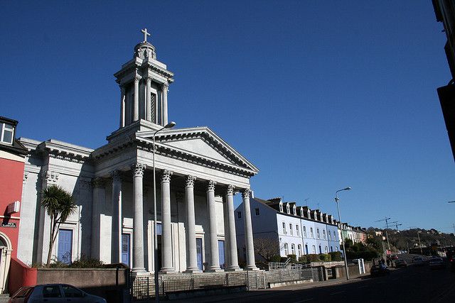 Catholic ChurchChurch · 7.4 mi
Explorer Tom Catholic Church in Farrankeal sits right next to the fair green, so it's probably seen some wild characters over the…
More archaeology and monuments in County Kerry · All of County Kerry

What do you know about this place?Tap to add a comment or ask a question