What is recorded here
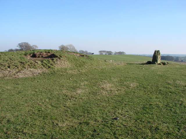
On an E-facing slope in a broadleaf plantation. A triangular sandstone slab (H 0.98m; Wth 0.36m; D 0.22m) oriented NNE-SSW in the centre of a mound (KK028-100----). There is a shallow depression (diam. c. 3m) around the base of the stone.
Compiled by: Mary Tunney
Date of upload: 23 October 2013
Probably dating to the Bronze Age, this standing stone may have had ritual or territorial significance. Its placement within a mound suggests possible funerary or ceremonial use, though specific folklore or detailed meaning is not recorded.
The monument record does not grant public access. Check the route and ask the landowner before entering private land.
- What survives
- Recorded monument
Places near here
 Church in KilcullenChurch · 1176 yd
 Óengus Osrithe's TumulusArchaeological place · 1569 yd
 Enclosure in KilcullenEnclosure · 1579 yd
 Brownsbarn Bridgebridge · 1.1 mi
 Site of Brittas CastleCastle, unclassified · 1.3 mi
 Saddle HillMountain / peak · 1.4 mi
 Site of Kilkieran CastleCastle, unclassified · 1.6 mi
 Dangan WoodForest · 1.8 mi
 James FrenyMemorial · 1.9 mi
 Graveyard in InistiogeGraveyard · 1.9 mi
 St. Mary's ChurchVisitor information · 1.9 mi
 St Colmcille's WellVisitor information · 1.9 mi