What is recorded here
Ballyvisteale holds a rectangular standing stone, 1.7 metres tall, tilted NE-SW on a west-facing pasture slope. Packing stones still crowd its base, proving the ground was shaped deliberately rather than left to chance. The exact hand that lifted it has vanished, but the angle and assembly suggest a boundary, marker or warning made visible for everyone passing that valley.
In pasture on W-facing slope. Rectangular stone (H 1.7m; 1m x 0.6m), long axis NE-SW. Packing-stones exposed at base.
The above description is derived from the published 'Archaeological Inventory of County Cork. Volume 2: East and South Cork' (Dublin: Stationery Office, 1994). In certain instances the entries have been revised and updated in the light of recent research.
Date of upload/revision: 14 January 2009
Dated to the Late Neolithic or Bronze Age, this standing stone may have had ritual or territorial significance. No specific folklore or inscriptions are recorded for this site.
The monument record does not grant public access. Check the route and ask the landowner before entering private land.
- What survives
- Recorded monument
Places near here
 Quarry in BrookvilleQuarry · 706 yd
 KilnKiln, corn-drying · 721 yd
 Carberrytown WoodWood · 1401 yd
 Old Court (Site of)Castle, unclassified · 1689 yd
 Sweathouse in Hermitage (barrymore By.)Sweathouse · 1.2 mi
 Gleeson MemorialMemorial · 1.3 mi
 Site of Grave YardBurial ground · 1.4 mi
 Sarsfields Court (in Ruins)Castle, unclassified · 1.7 mi
 Cork WalksVisitor information · 5.4 mi
 Tourist OfficeVisitor information · 5.6 mi
 Lavitts QuayMemorial · 5.7 mi
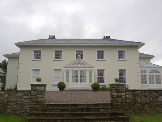 Brookvillecountry house · 724 yd