What is recorded here
St. Sorneys Bush stood about 125 metres east-northeast of the Drumacoo church, a living ritual marker named on the 1838 map but gone by 1933. It may have shaded weddings, births, arguments or quiet prayers, giving the neighbourhood a visible centre before people removed it. The earth keeps no branch, trunk or hole that can be pointed to, yet the name still directs us toward a lost living witness.
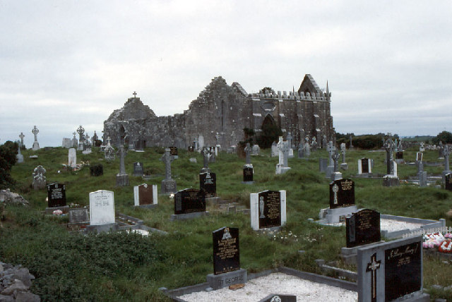
Some 125m to the ENE of the church (GA103-118001-) at Drumacoo. Named but not indicated on the 1838 edition of the OS 6-inch map; it had apparently been removed by the time of the 3rd edition (1933). No visible surface trace survives; not precisely located.
Compiled by: Galway Archaeological Survey, UCG
Date of upload: 15 December 2016
St. Sorneys Bush is associated with St. Senary (or Senan), a 6th-century Irish saint known for his healing miracles and monastic foundations along the west coast of Ireland. The site likely functioned as a place of pilgrimage and prayer, with traditions of curing ailments through water or ritual connected to the saint’s holy wells and shrines in the region.
The monument record does not grant public access. Check the route and ask the landowner before entering private land.
- What survives
- Recorded monument
Places near here
 Cross in DrumacooCross · 228 yd
 Station MonumentsPenitential station · 244 yd
 Drumacoomausoleum · 284 yd
 Drumacoo Monastic SiteHeritage attraction · 290 yd
 St. Sorneys WellHoly well · 345 yd
 Site of Kilcolgan CastleCastle, tower house · 1.1 mi
 MweenisharanIslet · 1.6 mi
 Ballynacourty Court (in ruins)Castle, hall-house · 2.3 mi
 Kilcornan ForestWood · 2.5 mi
 Fiddaun IslandIslet · 2.7 mi
 Loughaun WoodWood · 2.7 mi
 Mweenish PointHeadland · 2.7 mi