What is recorded here
From OpenStreetMap (© OpenStreetMap contributors) w683459252
Places near here
Photo credits
- Colin Park, Geograph · CC BY-SA 2.0
- Eric Jones, Geograph · CC BY-SA 2.0
- Ron Murray, Wikimedia Commons · CC BY-SA 2.0
- Oliver Dixon, Geograph · CC BY-SA 2.0
- Deathpool4 at English Wikipedia, Wikimedia Commons · Public domain
- Ross, Wikimedia Commons · CC BY-SA 2.0
- Eric Jones, Wikimedia Commons · CC BY-SA 2.0
 Clonlum South CairnArchaeological place · 733 yd
Explorer Tom Clonlum South Cairn is located near Meigh, four kilometers northwest of Flurrybridge in County Armagh, as recorded by Colin Park for this archaeological place.
 Round Cairn With Portal Tomb: South Cairn in ClonlumRound Cairn With Portal Tomb: South Cairn · 734 yd
Explorer Tom Round Cairn With Portal Tomb: South Cairn in Clonlum is a hybrid beast, mixing portal tomb and megalithic cist styles like a confused cocktail. It was damaged when locals raided it for building materials, which is peak cheekiness. It's the kind of place that makes a dull Tuesday interesting.
 Killeavy CastleCastle · 1129 yd
Explorer Tom Killeavy Castle sits on the slopes of Slieve Gullion, a dilapidated beauty that was originally just a farmhouse conversion in the early nineteenth century.
 Killevy ChurchesVisitor information · 1.4 mi
Explorer Tom Visit Killevy Churches, where the newer eastern church offers unique perspectives and a chance to appreciate the area's rich religious heritage.
 Early Christian & Medieval Churches, Graveyard, Augustinian Nunnery & Round Tower: Killevy Churches in BallintempleEarly Christian & Medieval Churches, Graveyard, Augustinian Nunnery & Round Tower: Killevy Churches · 1.4 mi
Explorer Tom Killevy Churches in Ballintemple has a round tower that’s seen it all since the 6th century. St Moninna is still chilling there, probably judging your outfit. Great spot to propose lunch, or maybe marriage if you’re brave.
 Killevy Churches aonb SignVisitor information · 1.4 mi
Explorer Tom Find the Killevy Churches AONB Sign at the junction of Church Road and Ballintemple Road, marking a special area of natural beauty.
 Faughill MountainMountain / peak · 1.4 mi
Explorer Tom Faughill Mountain once had a fortified watchtower called Romeo Two One on top, monitoring the strategic corridors below.
 Carn HillMountain / peak · 1.4 mi
Explorer Tom Carn Hill seems to double as a car breaker and transport yard, so watch out for odd vehicles here!
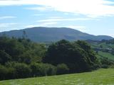 Cú Chulainn and Culann's Hound: Slieve GullionLegend location · 1.5 mi
Explorer Tom Cú Chulainn and Culann's Hound: Slieve Gullion has a boy, an attacking dog and the strangest job offer in Irish legend. Sétanta kills the hound, then volunteers to guard the smith's house himself. He certainly knew how to make an introduction. Nobody can point to the exact doorstep today.
Slieve GullionMountain / peak · 1.5 miExplorer Tom Slieve Gullion looks impressive even from Aughanduff, and I bet climbing it will give you a truly grand perspective on the area.
 Fionn and the Cailleach: Slieve GullionLegend location · 1.5 mi
Explorer Tom Fionn and the Cailleach: Slieve Gullion begins with a lost ring in a lake. Fionn dives for it and comes up an old man, which is a steep price for being helpful. If anyone asks me to fetch jewellery from deep water, I am suddenly busy elsewhere.
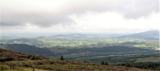 Ring of GullionRing of hills and protected landscape · 1.7 mi
Explorer Tom Ring of Gullion was Bandit Country, but now it's all about geo-tourism. It would tell a teenager that in the 1800s, everyone carried a sword and complained about the mud constantly. Look up, the best bit is always higher than you think.
More historic places in County Armagh · All of County Armagh

What do you know about this place?Tap to add a comment or ask a question