What is recorded here
A well is marked on the 1839 and 1940 eds of the OS 6-inch map where it is described in gothic lettering as St. Keevil’s Well. It is located on a level, low-lying landscape, just S of the old Wexford to Rosslare road. John O’Donovan writing c. 1840 says that the pattern was held on 27 August (O’Flanagan 1933, vol. 1, 281). The saint is St. Caoimheall, the daughter of Caomhlugh. She was the mother of four saints, three – Daghán, Méanóg and Molioba – with Wicklow connections (Ó Riain 2011, 148). She is also reputed to be the sister of St. Kevin (Caoimhghin) of Glendalough, and a church, now unlocated, was dedicated to her in north Kildare. The well at Ballybrennan is not evident and was probably destroyed in widening the N25 road.
A well is marked on the 1839 and 1940 eds of the OS 6-inch map where it is described in gothic lettering as St. Keevil’s Well. It is located on a level, low-lying landscape, just S of the old Wexford to Rosslare road. John O’Donovan writing c. 1840 says that the pattern was held on 27 August (O’Flanagan 1933, vol. 1, 281). The saint is St. Caoimheall, the daughter of Caomhlugh. She was the mother of four saints,…
From the National Monuments Service (Archaeological Survey of Ireland) record WX048-003
The monument record does not grant public access. Check the route and ask the landowner before entering private land.
- What survives
- Recorded monument
Places near here
Photo credits
- National Inventory of Architectural Heritage
- Sheila1988, Wikimedia Commons · CC BY-SA 4.0
- Cozzmick, Wikimedia Commons · CC BY-SA 4.0
- Yosemite, Wikimedia Commons · CC BY-SA 3.0
- Jean-Pol GRANDMONT, Wikimedia Commons · CC BY 3.0
- David Hawgood, Wikimedia Commons · CC BY-SA 2.0
- User Ali-oops on en.wikipedia, Wikimedia Commons · GFDL
- Mike Searle, Wikimedia Commons · CC BY-SA 2.0
 Ballybrennan HouseMill (wind) · 255 yd
 Ashfield HouseFarm house · 262 ydEnclosure in Yoletown (forth By., Rosslare Ed)Enclosure · 1548 ydEnclosure in Bush (forth By., Rosslare Ed)Enclosure · 1629 ydMarconi HouseMemorial · 2.3 mi
 Irish Agricultural MuseumMuseum · 3.7 mi
 CastleCastle, tower house · 3.7 mi
 Japanese cedar3.8 mi
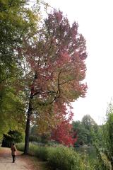 American Sweetgum3.8 mi
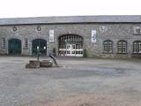 Johnstown CastleCastle · 3.8 mi
 Carne BeachBeach / strand · 5.5 mi
_-_geograph.org.uk_-_3715787.jpg/250px-Castles_of_Leinster,_Ballyhealy,_Wexford_(1)_-_geograph.org.uk_-_3715787.jpg "Photo: Mike Searle, Wikimedia Commons · CC BY-SA 2.0") Castle (in ruins)Castle, tower house · 6.0 mi
Castle (in ruins)Castle, tower house · 6.0 miMore archaeology and monuments in County Wexford · All of County Wexford
What do you know about this place?