What is recorded here
From OpenStreetMap (© OpenStreetMap contributors) n2799214652
Places near here
Photo credits
- Maker not stated on source page, www.pinterest.com
- Ridiculopathy, Wikimedia Commons · CC0
- Nedbrowne, Wikimedia Commons · CC0
- Maker not stated on source page, www.irelandhighlights.com
- Sharon Loxton, Geograph · CC BY-SA 2.0
- Florian Thiery , Peter Thiery, Wikimedia Commons · CC BY 4.0
- Dáibhí Ó Bruadair, Wikimedia Commons · CC BY-SA 4.0
- Nigel Cox, Wikimedia Commons · CC BY-SA 2.0
- New Graphic (photographer not stated), New Graphic
- Maker not stated on source page, www.flickr.com
 Fairy fort / stone ringfort in Baile An Chnocáin (tc Cill Chuain)Fairy fort / stone ringfort · 1217 yd
Explorer Tom Fairy fort / stone ringfort in Baile An Chnocáin ended up in the wrong place because someone misread a map badly. Now…
 Hachured, CloghaunFairy fort / earthen ringfort · 1547 yd
Explorer Tom Cloghaun in Baile Na Bhfionnúrach is incredibly proud of its view, even though it’s just a circle with one stone wall…
 Hachured, CathairFairy fort / stone ringfort · 1587 yd
Explorer Tom Cathair in Baile Na Bhfionnúrach is where a local priest lost a bet involving a goat and a very expensive hat. It’s…
 Cathair na BhFionnúrachArchaeological place · 1599 yd
Explorer Tom At the foot of Mount Brandon, Cathair na BhFionnúrach has a stone wall sturdy enough to make Tom suspect the local…
 Fairy fort / earthen ringfort in Na GrafaíFairy fort / earthen ringfort · 1.0 mi
Explorer Tom Fairy fort in Na Grafaí has one bird who refuses to leave despite the bad reviews. It overlooks the marshy plain with a…
 Binn DiarmadaMountain / peak · 4.6 mi
Explorer Tom Binn Diarmada in County Kerry promised the world would end when it sneezed, but it just hiccupped instead. The prophecy…
 Ogham stone in Baile An ReannaighOgham stone · 5.1 mi
Explorer Tom Ogham stone in Baile An Reannaigh has changed its name so many times it's basically a chameleon with commitment issues.…
 Dún an ÓirArchaeological place · 5.4 mi
Explorer Tom Dún an Óir is in a bitter feud with the rain, convinced it’s personally targeting its roof for some reason no one else…
 Dunanoir FortVisitor information · 5.4 mi
Explorer Tom Dunanoir Fort in County Kerry is where a fiddler played so loud that the sea actually got jealous and tried to drown…
 Riasc Monastic SettlementHeritage attraction · 5.7 mi
Explorer Tom Riasc, or Reask, is an early monastic site near Ballyferriter where low stone walls and house outlines ask you to use…
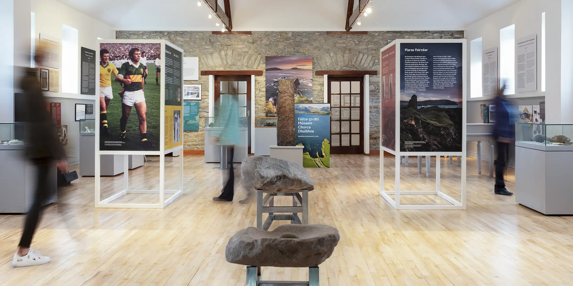 Músaem Chorca DhuibhneMuseum · 6.3 mi
Explorer Tom In Ballyferriter, the old schoolhouse has retired from correcting homework and taken up explaining an entire peninsula…
 Dunurlin Church (in ruins)Church · 6.6 mi
Explorer Tom Dunurlin Church is furious that people keep comparing it to Dingle, which is like comparing a cottage to a skyscraper.…
More viewpoints and information in County Kerry · All of County Kerry

What do you know about this place?Tap to add a comment or ask a question