
Places near here
Photo credits
- Richard Sutcliffe, Wikimedia Commons · CC BY-SA 2.0
- David Dixon, Wikimedia Commons · CC BY-SA 2.0
- Graham Robson, Wikimedia Commons · CC BY-SA 2.0
- Jerzy Morkis, Wikimedia Commons · CC BY-SA 2.0
- Linda Hogg, Wikimedia Commons · CC BY-SA 2.0
- William Starkey, Wikimedia Commons · CC BY-SA 2.0
- rob bishop, Wikimedia Commons · CC BY-SA 2.0
- Graeme Yuill, Wikimedia Commons · CC BY-SA 2.0
- Jim Bain, Wikimedia Commons · CC BY-SA 2.0
- Derek Harper, Wikimedia Commons · CC BY-SA 2.0
 St. Mary on the RockVisitor information · 280 yd
 St Andrews, the ShoreNo Class (event) · 327 yd
 St Andrews, Market StreetCoin (17th Century) · 341 yd
 St Mary's QuadPark · 346 yd
 St Andrews HarbourHarbour (medieval) · 387 yd
 St Andrews, Market StLithic Implement (prehistoric), Unidentified Pottery (medieval) · 446 yd
 St Andrews, 4 and 5 Balfour PlaceWorkers Row (19th Century) (1820) · 462 yd
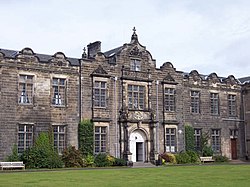 St Andrews UniversitySherd(s) (pottery)(13th Century) · 502 yd
 St Andrews, St Mary Street, Shore BridgeRoad Bridge · 502 yd
 St Andrews Harbour, BreakwaterBreakwater · 513 yd
 Woodburn ParkPark · 551 yd
 St Andrews, Leisure CentreNo Class (event) · 1107 yd
More archaeology and monuments in Fife · All of Fife

What do you know about this place?Tap to add a comment or ask a question