
Places near here
Photo credits
- N Chadwick, Geograph · CC BY-SA 2.0
- Elkay62, Wikimedia Commons · CC BY-SA 4.0
- Eric Jones, Geograph · CC BY-SA 2.0
- Eric Jones, Wikimedia Commons · CC BY-SA 2.0
- Golfing in Ireland; photographer not stated, Source publisher
- Albert Bridge, Wikimedia Commons · CC BY-SA 2.0
- Albert Bridge, Geograph · CC BY-SA 2.0
- Rossographer, Geograph · CC BY-SA 2.0
- thejackrustles, Geograph · CC BY-SA 2.0
- User:SeamusSweeney, Wikimedia Commons · CC BY-SA 3.0
 Scrabo HillMountain / peak · 233 yd
Explorer Tom Scrabo Hill in County Down is currently being judged by the local sheep, who think its tower looks ridiculous for…
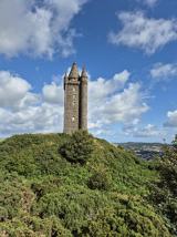 Scrabo TowerHeritage attraction · 249 yd
Explorer Tom I saw Scrabo from miles away and pretended I meant to find it. Scrabo Tower rises above Newtownards like a 41 metre…
 Tower in ScraboTower · 249 yd
Explorer Tom Tower in Scrabo was built by tenantry to make sure everyone remembered Charles William Vane forever, which is a lot of…
 Alexandra HouseHouse · 672 yd
Explorer Tom Alexandra House in Castleaverry is a Grade B1 beauty from the early 1900s that probably hosts the best tea parties in…
 Scrabo Golf ClubGolf course · 683 yd
 Walled GardenGarden · 738 yd
Explorer Tom Walled Garden in County Down has strong opinions on modern buildings, specifically that they’re too tall and not enough…
 Scrabo Railway BridgeRuins · 942 yd
Explorer Tom There are two Scrabo Railway Bridges, which is frankly ridiculous, but this one in County Down is definitely the more…
 Kiltonga Nature ReserveNature reserve · 1.3 mi
Explorer Tom Kiltonga Nature Reserve sits beside the Belfast Road at Newtownards, where a path circles the water and the local bird…
 Blair Mayne statueMonument · 1.3 mi
Explorer Tom Blair Mayne statue in County Down is standing there looking like he’s about to catch a bus that hasn’t come in years. I…
 Rough IslandIslet · 2.4 mi
Explorer Tom Rough Island’s family tree is mostly made up, with generations of ancestors who were definitely real but also…
 CairngaverMountain / peak · 3.0 mi
Explorer Tom Cairngaver has an imaginary twin across the sea who sends it postcards every year saying it looks better than it ever…
 Castle Espie Wetland CentreNature reserve · 3.4 mi
Explorer Tom Castle Espie puts Strangford Lough's birdlife close enough to make your binoculars feel like a backstage pass: follow…
More archaeology and monuments in County Down · All of County Down

What do you know about this place?Tap to add a comment or ask a question