
Places near here
Photo credits
- Sharon Loxton, Geograph · CC BY-SA 2.0
- colm, Geograph · CC BY-SA 2.0
- National Inventory of Architectural Heritage
- Superbass, Wikimedia Commons · CC BY-SA 4.0
- kevin higgins, Geograph · CC BY-SA 2.0
- Adrian King, Geograph · CC BY-SA 2.0
- Ridiculopathy, Wikimedia Commons · CC0
- Nigel Cox, Geograph · CC BY-SA 2.0
 Cnoc DuíléibheMountain / peak · 913 yd
Explorer Tom There was a dance here that went on so long the participants turned into stone out of exhaustion. Cnoc Duíléibhe still…
 Brandon PointViewpoint · 1.4 mi
Explorer Tom Brandon Point remembers the time a fox took charge of the local bird population and declared itself king for three days…
 Pointe na CathrachHeadland · 1.8 mi
Explorer Tom Pointe na Cathrach is where Saint Patrick supposedly tripped over his own robes and blamed the ground for being too…
An CheapaighBeach / strand · 2.0 miExplorer Tom An Cheapaigh beach in County Kerry looks like it was designed by a mother-in-law who only liked straight lines and grey…
An t'Oileán DubhIslet · 2.2 miExplorer Tom An t'Oileán Dubh is hiding a giant who lost his hat in 1790 and has been grumbling about it ever since, refusing to let…
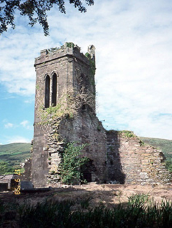 Séipéal an Clochán [Cloghane Church]Church/chapel · 2.6 mi
Explorer Tom Séipéal an Clochán would post a photo of itself falling apart with the caption 'living my best life'. It’s basically a…
 Cloghane ChurchRuins · 2.6 mi
Explorer Tom Cloghane Church ended up here because someone took a wrong turn in 1400 and never fixed the map error, so it’s been…
 Piaras MórMountain / peak · 3.1 mi
Explorer Tom Piaras Mór stands beside one of the Dingle Way's most memorable mountain crossings, and it still insists on being more…
 Fermoyle BeachBeach / strand · 4.2 mi
Explorer Tom Fermoyle Strand is what happens when Kerry gives a beach plenty of room and puts a mountain behind it for good measure.…
 CloghaunHut site · 5.6 mi
Explorer Tom Cloghaun is proud of its one surviving wall, having lost its twin in a mysterious argument. It's an oval drystone thing…
 Hachured, CloghaunFairy fort / earthen ringfort · 5.7 mi
Explorer Tom Cloghaun in Baile Na Bhfionnúrach is incredibly proud of its view, even though it’s just a circle with one stone wall…
 Gurrig IslandIslet · 6.0 mi
Explorer Tom Gurrig Island means 'The Rock That Got Stuck' in ancient Irish, or at least that's what Tom thinks it says after three…
More walking routes in County Kerry · All of County Kerry

What do you know about this place?Tap to add a comment or ask a question