
What is recorded here
'sithean Harraig' is a broch in Highland, Scotland.
Places near here
Picture notes
- Computer-made picture. It does not show this monument.
- John Ferguson, Wikimedia Commons · CC BY-SA 2.0
- Alan Reid, Wikimedia Commons · CC BY-SA 2.0
- Phil Williams, Wikimedia Commons · CC BY-SA 2.0
- david glass, Wikimedia Commons · CC BY-SA 2.0
- Rude Health, Wikimedia Commons · CC BY-SA 2.0
- Computer-made picture. It does not show this garden.
- David Bremner, Wikimedia Commons · CC BY-SA 2.0
 Sithean Harraig, BrochArchaeological place · 2 ydComputer-made picture
 ScotscalderRig and Furrow (medieval) - (post Medieval) · 709 ydComputer-made picture
 TongsideFarm, Sluice · 735 yd
 Scotscalder, Snow FencesSnow Fence(s) (20th Century) · 790 ydComputer-made picture
 Torr PoiteachMound · 1307 ydComputer-made picture
 Torr A' GheodhHut Circle (prehistoric) · 1361 ydComputer-made picture
 Loch CalderFarmstead · 1.0 mi
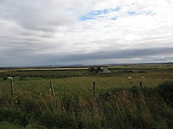 Battle of HarpsdaleBattle · 1.4 mi
 BlackparkFarm, Lade, Mill (possible), Sluice · 1.7 mi
 Beinn FreiceadainMountain / peak · 2.4 mi
 Dale House, walled gardenGarden · 3.6 miComputer-made picture
 Achlachan MossForest · 3.6 mi
More archaeology and monuments in Highland · All of Highland

What do you know about this place?Tap to add a comment or ask a question