Places near here
Photo credits
- Roger McLachlan, Wikimedia Commons · CC BY-SA 2.0
- Otter, Wikimedia Commons · CC BY-SA 3.0
- Tom Richardson, Wikimedia Commons · CC BY-SA 2.0
- Hector Davie, Wikimedia Commons · CC BY-SA 2.0
- Hugh Venables, Wikimedia Commons · CC BY-SA 2.0
- Alan Morrison, Wikimedia Commons · CC BY-SA 2.0
- Oliver Dixon, Wikimedia Commons · CC BY-SA 2.0
- F Leask, Wikimedia Commons · CC BY-SA 2.0
- Sandy Gerrard, Wikimedia Commons · CC BY-SA 2.0
- Barbara Carr, Wikimedia Commons · CC BY-SA 2.0
 Dead monitor on Borgh beachBeach · 289 yd
 Dead marine animal on the beachBeach · 336 yd
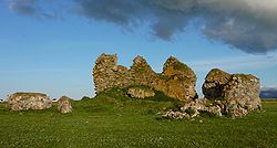 Borve CastleCastle · 1185 yd
 Sandy cliff like duneCliff or headland · 1617 yd
 Lews Castle College, Benbecula CampusCastle, fort or tower · 1737 yd
 Oats stookked opposite Liniclate SchoolHeritage place · 1.0 mi
 Screen machine at Dark Island HotelIsland · 1.0 mi
 Benbecula, LiniclateHotel · 1.1 mi
 Scottish Cooking Bus at the Dark Island HotelIsland · 1.1 mi
 Culla, BenbeculaSettlement, Site · 2.3 mi
 Benbecula, Nunton, Ruin of St Mary's ChapelBurial Ground(s) (medieval), Chapel (medieval), Cross · 2.5 mi
 War MemorialMemorial · 2.6 mi
More cliffs, bays and coast in Na h-Eileanan Siar · All of Na h-Eileanan Siar

What do you know about this place?Tap to add a comment or ask a question