
What is recorded here
On a rise in level Meath country, the old church vanished completely, leaving only a D-shaped graveyard and straight stone walls to mark where worship happened. Headstones from 1780 to 1930 still stand inside that quiet boundary, testifying that the place remained alive long after the building disappeared. The church appeared in papal tax lists in 1302, survived into the seventeenth century as a ruin with standing walls, and was eventually replaced by a neat new edifice in 1800. What is gone is not forgotten; the graveyard still holds the shape of the lost house.
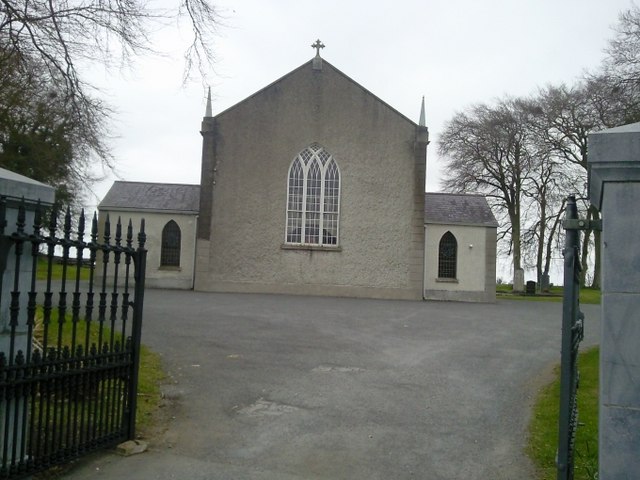
Situated on a rise in a fairly level landscape. A church at Balimacglassan is listed in the ecclesiastical taxation (1302-06) of Pope Nicholas IV (Cal. doc. Ire., 5, 254). Ussher (1622) describes the church as in reasonable repair but the chancel was ruined (Erlington 1847-64, 1, lxxi). A ruined church is marked on the Down Survey (1656-8) parish map at Ballymaglassan. According to Dopping (1682-5) the church and chancel of St Kenan’s (Kieran ?) were ruined since 1641 but the walls were standing and the graveyard was not enclosed (Ellison 1971, 38). A new church, described as a ‘neat little edifice’ was built in 1800 (Lewis 1837, 1, 146), but this is now closed. The E window from this church, which had come from the Church of Ireland church at Ratoath is now in the E wall of St Seachnall's Church of Ireland Church at Dunshaughlin (Kenny 1994-5). The site of the medieval church, of which there is no physical trace, is within a D-shaped graveyard (max. dims c. 50m NE-SW; c. 40m NW-SE) defined by masonry walls with straight sides at NE and SE. The headstones date from c. 1780 to c. 1930 and have been published (ibid).
The above description is derived from the published 'Archaeological Inventory of County Meath' (Dublin: Stationery Office, 1987). In certain instances the entries have been revised and updated in the light of recent research.
Compiled by: Michael Moore
Date of upload/revision: 10 April, 2015
The monument record does not grant public access. Check the route and ask the landowner before entering private land.
- What survives
- Recorded monument
Places near here
 Saint Keiran's Church (Ballymaglassan)church/chapel · 21 yd
 Site of Old CastleEnclosure · 1097 yd
 Enclosure in BallymaglassanEnclosure · 1297 yd
 Lismahon 1798 MemorialMonument · 1316 yd
 Catholic Church of the Assumptionchurch/chapel · 1.4 mi
 Saint Oliver Plunkett 1625-1681Memorial · 2.2 mi
 CastleCastle, motte · 2.5 mi
 Mulhussy CastleCastle, tower house · 3.2 mi
 Hanwood GardensHeritage attraction · 3.2 mi
 MullaghMountain / peak · 3.4 mi
 Ash HillMountain / peak · 3.4 mi
 Lebanon CedarLebanon Cedar · 4.2 mi
Other information
Photo: Credit not shown in the picture search · Rights wording not checked; contact us if this picture should be removed