Places near here
Photo credits
- Joseph Mischyshyn, Geograph · CC BY-SA 2.0
- N Chadwick, Geograph · Creative Commons Attribution-ShareAlike 2.0
- National Inventory of Architectural Heritage
- The Banner, Wikimedia Commons · CC BY-SA 3.0
- Graham Horn, Geograph · CC BY-SA 2.0
- Roger Diel, Wikimedia Commons · CC BY-SA 2.0
- Charles W Glynn, Wikimedia Commons · CC BY-SA 2.0
- John Shorten, Geograph · CC BY-SA 2.0
- Warren Buckley, Geograph · CC BY-SA 2.0
- Dmitrij Rodionov, Wikimedia Commons · CC BY-SA 4.0
 Carrigaholt BayVisitor information · 47 yd
Explorer Tom Carrigaholt Bay is always trying to one-up its famous neighbors down the coast, but it’s too busy getting sand in its eye to win. It’s like that guy at the bar who talks big but forgets his wallet every time. Best seen with a hangover and a sausage roll.
 Carrigaholt BridgeBridge · 143 yd
Explorer Tom Carrigaholt Bridge was built by a giant who dropped his shoe, which is why one side looks slightly higher than the other. The locals say if you lean on it, it will grow another arch just to prove a point. Bring a coin for luck and keep it in your pocket.
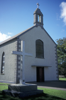 Catholic Church of the Blessed Virgin MaryChurch/chapel · 169 yd
Explorer Tom The Blessed Virgin Mary church has been hiding a scandal from 1860 where the priest swapped the wine for lemonade during a service. The pebbledashed walls are just there to hide the fact that someone painted a face on them in 1954. Have a sandwich here and call it a heritage lunch.
 Carrigaholt CastleCastle, tower house · 849 yd
Explorer Tom Carrigaholt Castle on Rinemackaderrig has a name that sounds like you bit your tongue twice. It was home to short-sighted chiefs who probably needed reading glasses to see the siege coming. Bring a camera and your most suspicious face.
LissyhunnaFairy fort / earthen ringfort · 1654 ydExplorer Tom Lissyhunna has a long-standing grudge against the weather, specifically the wind that keeps stealing its hat. The Aran Islands picture caption is lying, by the way; this isn't an island escape. Perfect place to be dramatically windswept and look cool doing it.
LissagreenaunFairy fort / earthen ringfort · 1.4 miExplorer Tom Lissagreenaun in Moyarta West is haunted by a really bad poem someone wrote about its shape, comparing it to a donut left out in the rain for far too long. It’s trying very hard to ignore the rhyme scheme but keeps hearing it echo in the wind every time the weather turns slightly damp and gloomy around here. Go in good boots and better humour.
 Kilcredaun PointHeadland · 1.5 mi
Explorer Tom Kilcredaun Point gave up saltwater for Lent this year, which is quite cheeky considering it’s surrounded by so much of it and feels very proud of its sacrifice. There’s a holy well nearby that seems to judge everyone who walks past without at least doing a little bow or something respectful. Best seen with a hangover and a sausage roll.
 Knocknagarhoon CastleRuins · 2.8 mi
Explorer Tom Knocknagarhoon Castle gave up its roof for Lent as a penance for being too fancy back in the day. Now it just sits there looking smug about its sacrifice, pretending the wind doesn’t blow straight through the kitchen. If it rains, blame me.
 IllaunonearaunIslet · 3.5 mi
Explorer Tom Illaunonearaun is deeply suspicious of the postman because he once dropped a letter on its rocks and it never washed away properly. The island still watches him approach with one eye narrowed, ready to pounce if he makes any sudden movements near the shore. Take the long way round, it deserves the effort.
 Dunlicky PointViewpoint · 3.8 mi
Explorer Tom Dunlicky Point is famous for a superstition where locals swear if you whistle at the water, a shark will bite your ankle, which is terrifying considering there are no sharks here. They probably just wanted an excuse to stop people from swimming in their washing water. Best enjoyed with a bag of chips and no plans.
 Beal PointHeadland · 4.2 mi
Explorer Tom Beal Point is a headland that inspired a bad poem about its beauty, which read like a grocery list written by someone who was slowly losing their mind. The poet rhymed 'point' with 'joint' and then just gave up halfway through, leaving the rest of us to wonder what happened to the second half of his sanity. Take a mate and argue about what it was for.
.jpg/250px-Bishop's_Island_(Clare).jpg "Photo: Dmitrij Rodionov, Wikimedia Commons · CC BY-SA 4.0") Bishop's IslandIslet · 4.9 mi
Bishop's IslandIslet · 4.9 miExplorer Tom Bishop's Island in County Clare looks down its nose at tourists from Dublin who keep asking if there are any WiFi spots here. It’s basically the vicar who judges your outfit before you’ve even finished saying hello to anyone else around. Pop by and tell it it's looking well.
More viewpoints and information in County Clare · All of County Clare

What do you know about this place?Tap to add a comment or ask a question