Places near here
Photo credits
- National Inventory of Architectural Heritage
- Garry Dickinson, Geograph · CC BY-SA 2.0
- Keith Cunneen, Geograph · CC BY-SA 2.0
- Kmcnamee, Wikimedia Commons · CC BY-SA 4.0
- Nigel Cox, Geograph · CC BY-SA 2.0
- Nigel Thompson, Wikimedia Commons · CC BY-SA 2.0
- Phil Champion, Geograph · CC BY-SA 2.0
- Eileen Henderson, Geograph · CC BY-SA 2.0
- Wikimedia Commons contributor · CC BY-SA 3.0
- DavidBosonnet, Wikimedia Commons · CC BY-SA 4.0
- Rossographer, Geograph · CC BY-SA 2.0
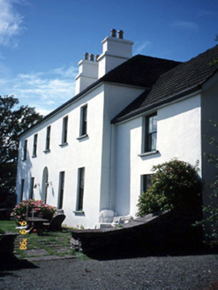 Westcove HouseHouse · 1560 yd
Explorer Tom Westcove House in Coad had a first owner whose escape plan involved hiding in the garden until everyone left. It’s…
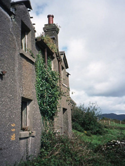 coastguard station1568 yd
Explorer Tom Coastguard station in Coad has a long grudge against the weather for ruining its ruins. It was once a sanatorium, which…
 Castle Cove (in Ruins)Castle, tower house · 1.3 mi
Explorer Tom Castle Cove is built on a rock outcrop where O'Sullivan Mores and Brennans both claim credit, so the seagulls probably…
 Eagles HillMountain / peak · 1.6 mi
Explorer Tom Eagles Hill has a hidden treasure buried under the ridge that is definitely just an old biscuit tin filled with rust…
 Derrynane GAA pitchGAA ground · 1.9 mi
 CaherdanielFairy fort / stone ringfort · 2.0 mi
Explorer Tom Caherdaniel had a fox take charge of the whole operation back in the day. It wore a tiny hat and barked orders at the…
 Caherdaniel Stone FortVisitor attraction · 2.0 mi
Explorer Tom Caherdaniel Stone Fort in Kerry has confused map makers so badly they gave up and started guessing. The name is long…
 White StrandBeach / strand · 2.2 mi
Explorer Tom White Strand near Castlecove hides a tunnel to the pub, according to one very tall tale. The locals say it only opens…
 Ogham StoneVisitor information · 2.6 mi
Explorer Tom Ogham Stone stands there near Derrynane House, covered in ancient scratches that locals swear will turn your hair green…
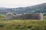 Staigue FortFairy fort / stone ringfort · 2.8 mi
Explorer Tom Staigue Fort in Staigue, County Kerry was saved by a hero nobody remembers. It has lintelled doors and chambers that…
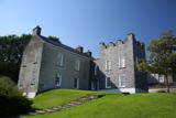 Derrynane House / Teach Dhoire FhionáinHeritage attraction · 3.0 mi
Explorer Tom Derrynane House has a superstition that locals swear by: if you touch the wall three times, your luck improves slightly…
 Derrynane Beach / Trá Doire FhíonáinBeach / strand · 3.1 mi
Explorer Tom Derrynane Beach in County Kerry would say 'I have excellent teamwork skills' in a job interview. It basically holds up…
More archaeology and monuments in County Kerry · All of County Kerry

What do you know about this place?Tap to add a comment or ask a question