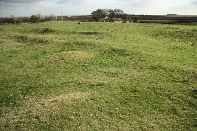
What is recorded here
Situated on a low hillock in a mountainous region. 'In 1301-4 the township of Lotragh owes 40s. for murage money received and not applied to the work', which according to Bradley (1985, 58) would suggest that the settlement was incorporated. Graham (1978, 42) lists Latteragh as a medieval borough based on reference to the borough of Latteragh in the seventeenth century. No earthworks visible at ground level in association with this settlement. Sites at Latteragh include a church and graveyard (TN028-025002), and a castle (TN028-025001).
The above description is derived from 'The Archaeological Inventory of County Tipperary. Vol. 1 - North Tipperary' compiled by Jean Farrelly and Caimin O'Brien (Dublin: Stationery Office, 2002). In certain instances the entries have been revised and updated in the light of recent research.
Date of upload/revision: 22 September 2008
The monument record does not grant public access. Check the route and ask the landowner before entering private land.
- What survives
- Recorded monument
Places near here
 Latteragh Housefarmyard complex · 63 yd
 Latteragh Church (in Ruins), Grave YardChurch · 85 yd
 Latteragh Castle (in ruins)Castle, Anglo-Norman masonry castle · 94 yd
 ToberoranHoly well · 1022 yd
 Interragh HillMountain / peak · 1397 yd
 Moat of LatteraghCastle, motte · 1459 yd
 Enclosure in Glenmore UpperEnclosure · 1.0 mi
 Killavalla WoodForest · 1.7 mi
 Knockacraheen HillMountain / peak · 2.1 mi
 Kyleroe WoodWood · 4.0 mi
 James Devaney MemorialMemorial · 7.5 mi
 Silvermines ViewpointViewpoint · 8.1 mi
Other information
Photo: Credit not shown in the picture search · Rights wording not checked; contact us if this picture should be removed