What is recorded here
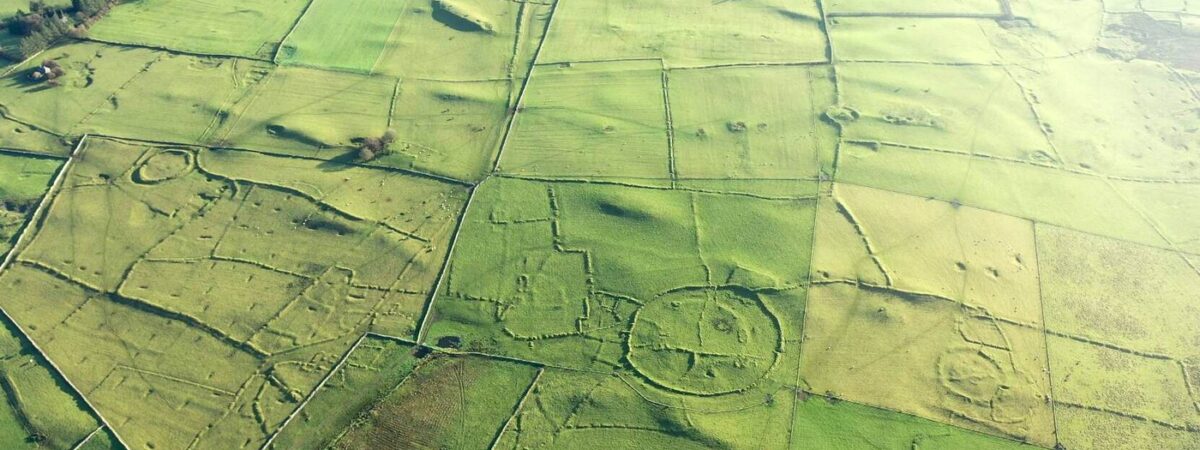
In a slight fold on the gentle S-facing slope at Rathcroghan. An area of c. 2.5 ha (c. 6 acres) within field system (RO022-057032-) and N of the concentric enclosure Relig na Rí (RO022-057037-) contains at least six houses. They appear as grass-covered areas (ext. dims. c. 11m x c. 5m to c. 19m x c. 9.5m) defined by low earthen banks (Wth 1-2.5m; H up to 0.5m) or low scarps, and are integrated with the field banks. Only one has two rooms, but the three largest have entrances in each long wall, while two have no apparent entrances. No street or road can be identified, but the field system is at its most complex here with numerous small paddocks (dims. c. 20m x c. 30m). Three houses placed close together are aligned N-S while the three others are aligned E-W and more dispersed. The house (RO022-057037-) at Relignaree (RO022-057035-), and the other houses investigated there in 1913 (Waddell 1983, 26), are outliers of the settlement.
See the attached aerial view looking W where some of the houses can be seen
Compiled by: Michael Moore
Date of upload: 24 August 2010
The monument record does not grant public access. Check the route and ask the landowner before entering private land.
- What survives
- Recorded monument
Places near here
 RelignareeConcentric enclosure · 300 yd
 Ceremonial enclosure in Glenballythomas,toberroryCeremonial enclosure · 608 yd
 Ancient RoadRoad, road/trackway · 1.1 mi
 CastlerubyCastle, unclassified · 1.8 mi
 RoadRoad, road/trackway · 1.8 mi
 European ashEuropean ash · 1.9 mi
 ToberagullaSpring · 1.9 mi
 CastleCastle, unclassified · 2.5 mi
 Cruachan Aí Heritage CentreMuseum · 2.5 mi
 War of Independence Commemorative Military MemorialMemorial · 4.6 mi
 Silver IslandIslet · 6.8 mi
 Gray's WoodForest · 7.3 mi