What is recorded here
From OpenStreetMap (© OpenStreetMap contributors) n332373507
Places near here
Photo credits
- Jonathan Billinger, Wikimedia Commons · CC BY-SA 2.0
- National Inventory of Architectural Heritage
- liam murphy, Wikimedia Commons · CC BY-SA 2.0
- N Chadwick, Geograph · CC BY-SA 2.0
- N Chadwick, Geograph · Creative Commons Attribution-ShareAlike 2.0
- Malene Thyssen, Wikimedia Commons · CC BY-SA 3.0
- Christian Pirkl, Wikimedia Commons · CC BY-SA 3.0 at
- Jonathan Billinger, Geograph · CC BY-SA 2.0
 Clonmore Catholic ChurchChurch/chapel · 1.6 mi
Explorer Tom Clonmore Catholic Church retains two wall monuments from c. 1825, adding a lovely touch of history to its cruciform plan.
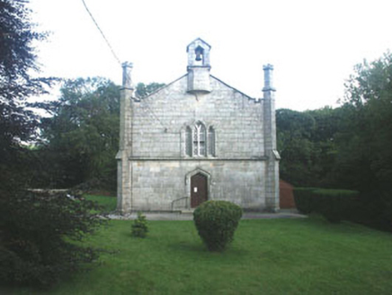 Mullinacuff ChurchChurch/chapel · 1.9 mi
 Clonmore Castle (in Ruins)Castle, Anglo-Norman masonry castle · 2.1 mi
Explorer Tom This thirteenth-century Clonmore Castle was a fortress of roughly coursed granite rubble with rectangular towers and an enclosed courtyard.
 Clonmore MoatCastle, motte and bailey · 2.2 mi
Explorer Tom Clonmore Moat is a steep-sided mound surrounded by a fosse, accompanied by an unattached trapezoidal bailey with its own defences.
Church (in ruins), GraveyardChurch · 2.2 miExplorer Tom The granite boulders forming this Crecrin church’s foundations suggest a sturdy home for worship, marked by a small piscina in the south wall.
Ballynultagh HillMountain / peak · 2.3 mi Cross-slab in Aghowle Lower (shillelagh By.)Cross-slab · 2.7 mi
 Graveyard2.7 mi
 European Beech3.2 mi
 Sycamore3.2 mi
 Eagle HillMountain / peak · 4.0 mi
Explorer Tom Eagle Hill south of Hacketstown is topped with a cross; imagine soaring above the fields just like the bird that named it!
Acaun Church (in ruins), GraveyardChurch · 5.0 miExplorer Tom Within Lisnevagh’s D-shaped enclosure, Acaun Church’s simple rectangular remains and nearby Latin cross hint at a deep, spiritual Carlow heritage.
More mountains and hills in County Wicklow · All of County Wicklow
What do you know about this place?Tap to add a comment or ask a question