What is recorded here
From OpenStreetMap (© OpenStreetMap contributors) n332373048
Places near here
Photo credits
- Maker not stated on source page, ru.pinterest.com
- Maker not stated on source page, www.pinterest.com
- Maker not stated on source page, br.pinterest.com
- Maker not stated on source page, www.dreamstime.com
- Jonathan Thacker, Wikimedia Commons · CC BY-SA 2.0
- Ceoil at English Wikipedia, Wikimedia Commons · CC BY-SA 3.0
- Maker not stated on source page, it.pinterest.com
- Maker not stated on source page, in.pinterest.com
- Maker not stated on source page, www.flickr.com
- National Inventory of Architectural Heritage
 Gallaunayarra Stone CirclesAnomalous stone group · 1.1 mi
Explorer Tom Gallaunayarra Stone Circles in Annagannihy has nine stones enclosing a 6-metre area on Knockcraugh Mountain. Two taller…
 Anomalous stone group in CarrigagullaAnomalous stone group · 1.3 mi
Explorer Tom Anomalous stone group in Carrigagulla: It’s hidden in the forestry, likely cursed by anyone who doesn’t wave their hand…
 Fairy fort / earthen ringfort in CarrigagullaFairy fort / earthen ringfort · 1.3 mi
Explorer Tom Fairy fort in Carrigagulla was recorded back in 1917 but now it’s hidden in forestry. Conlon said it was in a ruined…
Anomalous stone group in AnnagannihyAnomalous stone group · 1.5 miExplorer Tom Anomalous stone group in Annagannihy is a standing stone and prostrate rocks under a coniferous plantation. The exact…
 Stone CircleStone circle, five-stone · 1.6 mi
Explorer Tom Stone Circle in Carrigagulla, County Cork has an irregular outline and one stone angled inwards like it's trying to…
 MusheraMountain / peak · 1.8 mi
Explorer Tom Mushera claims to be older than the concept of time itself, which is a stretch even for a mountain. I say it’s just old…
 Carrigagulla Stone CircleArchaeological place · 1.8 mi
Explorer Tom Carrigagulla Stone Circle near Millstreet is a small Bronze Age ring in a clearing among conifers, where five stones…
 Fairy fort / earthen ringfort in CarrigthomasFairy fort / earthen ringfort · 4.1 mi
Explorer Tom Fairy fort / earthen ringfort in Carrigthomas is all talk and no show, with no visible trace left on the surface. Mr.…
 Standing stone in Bawnmore (muskerry West By.)Standing stone · 4.8 mi
Explorer Tom Standing stone in Bawnmore is barely a meter high and looks more like a very upright rock that got tired of rolling…
 Knocknakilla Stone CircleArchaeological place · 5.0 mi
Explorer Tom Knocknakilla Stone Circle in County Cork hides a tunnel to the pub, or so the legend goes. Nobody has found it yet…
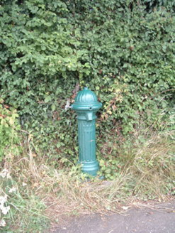 water pump11 mi
Explorer Tom Water pump in Mullaghroe North has been standing there since the 1880s, looking very Victorian about it. It’s a…
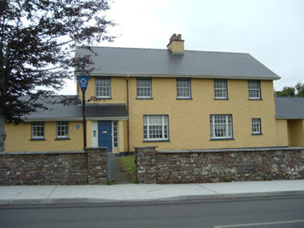 Knocknagree Garda StationGarda station/constabulary barracks · 14 mi
Explorer Tom 17. Knocknagree Garda Station looks like a fancy country house because it was built in the Domestic Revival style…
More mountains and hills in County Cork · All of County Cork

What do you know about this place?Tap to add a comment or ask a question