What is recorded here
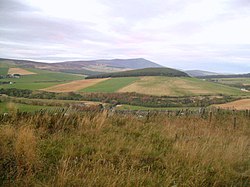
Scalan, Pond is a dam in Moray, Scotland.
Places near here
Photo credits
- Antony Dixon, Wikimedia Commons · CC BY-SA 2.0
- Steve Reid, Wikimedia Commons · CC BY-SA 2.0
- Trevor Littlewood, Wikimedia Commons · CC BY-SA 2.0
- Stanley Howe, Wikimedia Commons · CC BY-SA 2.0
- Dorothy Carse, Wikimedia Commons · CC BY-SA 2.0
- Anne Burgess, Wikimedia Commons · CC BY-SA 2.0
- Richard Webb, Wikimedia Commons · CC BY-SA 2.0
- ian shiell, Wikimedia Commons · CC BY-SA 2.0
- Ann Harrison, Wikimedia Commons · CC BY-SA 2.0
 College of ScalanHeritage attraction · 128 yd
 Scalan SeminaryMuseum · 129 yd
 Scalan, BuildingBuilding · 156 yd
 Scalan, Bishop's WellWell · 206 yd
 Clash of ScalanShieling Mound (post Medieval) · 858 yd
 East AuchavaichCairn · 1555 yd
 Tom a VoanMountain / peak · 1.0 mi
 Tom TrumperMountain / peak · 1.0 mi
 Well of lechtSpring · 2.2 mi
 Lecht MineVisitor information · 2.6 mi
 Buiternach WoodForest · 2.7 mi
 Battle of GlenlivetBattle · 6.2 mi
More archaeology and monuments in Moray · All of Moray

What do you know about this place?Tap to add a comment or ask a question