What is recorded here
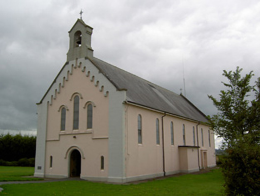
Freestanding gable-fronted Roman Catholic church, dated 1936, having seven-bay nave elevations, chancel projection to west, sacristy to south-west corner, and recent lean-to boilder house to west gable. Confessionals in projections to middle of long walls. Pitched artificial slate roofs with cut limestone copings, replacement uPVC rainwater goods and lined-and-ruled rendered bellcote to gable-front with cast-iron cross finial and bell, and with cross finial to west gable. Painted smooth rendered walls with render plinth, front façade having rendered string course and lined-and-ruled rendered quoins rising to apex of gable-front with corbel detailing. Carved limestone plaque to gable-front. Round-headed windows to nave and to triple-light gable-front window, having stained glass, those to gable-front having render hood-mouldings. Round-headed door opening to gable-front with chamfered render surround, render hood-moulding and painted timber door with decorative now disused wrought-iron hinges. Square-headed doorway to south wall with projecting rendered surround. Square-headed door opening to sacristy with replacement timber battened door and overlight. Sacristy has round-headed windows and square-headed doorway. Interior of church has carved timber gallery, staircase and entrance doors and carved marble tabernacle. Set back from road in lawned site with pebbledashed boundary walls and cast-iron double-leaf and pedestrian gates.
This simple church occupies a slightly elevated position just on the edge of the village of Dromina. The contrast of lined-and-ruled and smooth render to the façade lends textural interest, further enlivened by the render machicolation-type detailing of the gable-front. This church is a pleasant feature in both the streetscape and surrounding landscape.
This does not grant access. Most recorded buildings are privately owned; view them only from public ground unless the owner allows entry.
Places near here
 Castlehill BridgeBridge · 474 yd
 Castle (Site of)Castle, unclassified · 492 yd
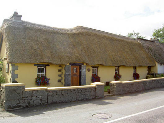 Bridge Househouse · 695 yd
 Fulacht fia in Killabraher NorthFulacht fia · 1295 yd
 Church (Site of)Church · 1655 yd
 Castle (in Ruins)Castle, Anglo-Norman masonry castle · 2.7 mi
 Windmill HillMountain / peak · 3.1 mi
 Battle of LiscarrollMajor battlefield · 3.4 mi
 Ballyhoura WayWalking route · 4.4 mi
 National Co-op MuseumMuseum · 4.9 mi
 Churchtown TrailsVisitor information · 5.0 mi
 ToberacappeenSpring · 5.3 mi
Other information
Photo: National Inventory of Architectural Heritage · Website use allowed for educational or private purposes with source credit