Places near here
Photo credits
- Willow, Wikimedia Commons · CC BY 2.5
- Kenraiz, Wikimedia Commons · CC BY-SA 3.0
- Andreas F. Borchert, Wikimedia Commons · CC BY-SA 4.0
- Oliver Dixon, Geograph · CC BY-SA 2.0
- Kmcnamee, Wikimedia Commons · CC BY-SA 4.0
- National Inventory of Architectural Heritage
- Drumkeerin GAA (official club site publisher); individual photographer not named, drumkeeringaa.com
- Pampuco, Wikimedia Commons · CC BY-SA 4.0
- Michael Murtagh, Geograph · CC BY-SA 2.0
- Dieglop, Wikimedia Commons · CC BY-SA 4.0
 European ash1.7 mi
Explorer Tom European Ash would order a large chipper with extra gravy and no vegetables. It’s a heritage tree that looks like it’s…
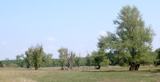 Black Poplar1.7 mi
Explorer Tom Black Poplar has a secret it would only tell after a few pints of stout. It’s been standing there judging everyone who…
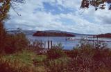 Lough AllenLarge freshwater lake · 1.8 mi
Explorer Tom Locals swear if you whistle at Lough Allen, a ghost will row your boat in circles until you apologise properly. It’s…
 Scardan WaterfallWaterfall · 1.9 mi
Explorer Tom Scardan Waterfall is tucked into Leitrim's hills above Lough Allen, where the Miners Way passes and a small car park…
 Ballinaglera GAAGAA ground · 3.7 mi
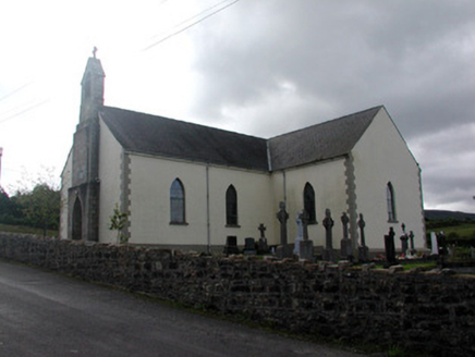 Saint Hugh's Catholic ChurchChurch/chapel · 3.8 mi
Explorer Tom Saint Hugh's Catholic Church in Drumnafinnila saw a love story go terribly wrong next door. The stained glass still…
 Drumkeerin GAAGAA ground · 4.0 mi
 Sliabh an IarainnMountain / peak · 4.7 mi
Explorer Tom Sliabh an Iarainn calls itself the iron mountain and has the old workings to back up the name. It rises 585 metres east…
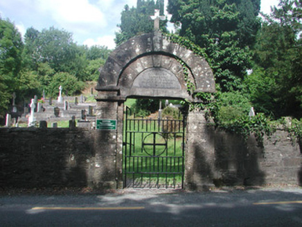 graveyard/cemetery5.3 mi
Explorer Tom Graveyard in Churchacres has a New Year’s resolution to stop being so interesting because all that fourteenth-century…
 CrockaunsMountain / peak · 18 mi
Explorer Tom Crockauns bragged about surviving a storm so violent it rearranged its own topography and sent the local cows into a…
 Glencar IslandIslet · 19 mi
Explorer Tom Glencar Island in County Leitrim would complain to the council about the noise levels from the swans, claiming they’re…
 Glencar WaterfallVisitor information · 19 mi
Explorer Tom Glencar Waterfall in County Leitrim gave up sugar for Lent but ended up eating a whole wheel of cheese instead anyway.…
More historic places in County Leitrim · All of County Leitrim

What do you know about this place?Tap to add a comment or ask a question