
What is recorded here
Rossorry Church in Mullanacaw has two sorts of authority taking an interest: heaven above and the people who gave it a Grade B listing. On Judgement Day, expect one of them to ask whether the original windows survived.
Current recorded use: Church.
From the Northern Ireland Historic Buildings Record record HB12/19/033
The official record and map point do not grant access. Many historic buildings are privately owned; view them only from public ground unless the owner allows entry.
Places near here
 Thistlebank HouseHouse · 1460 yd
 Portora CastleCastle · 1468 yd
 Castle IslandIslet · 1649 yd
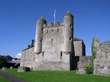 Enniskillen CastleCastle · 1721 yd
 Enniskillen castle in EnniskillenEnniskillen Castle · 1748 yd
 Boer War MemorialMemorial · 1.0 mi
 Methodist Church HallHall · 1.1 mi
 C18th church with C17th tower, & graveyard: enniskillen church in EnniskillenC18th Church with C17th Tower, & Graveyard: Enniskillen Church · 1.2 mi
 Remembrance Day bombingBomb attack · 1.4 miSiege of EnniskillenSiege · 1.4 mi
 Cole's MonumentMonument · 1.5 mi
 Devenish Island Round TowerViewpoint · 1.8 mi
Pictures: N Chadwick, Wikimedia Commons · CC BY-SA 2.0; Kenneth Allen, Wikimedia Commons · CC BY-SA 2.0; N Chadwick, Geograph · CC BY-SA 2.0; Raymond Millar, Wikimedia Commons · CC BY-SA 2.0; Kenneth Allen, Geograph · CC BY-SA 2.0; Colin Park, Geograph · CC BY-SA 2.0; Dean Molyneaux, Wikimedia Commons · CC BY-SA 2.0; Rosemary Nelson, Geograph · CC BY-SA 2.0
More historic places in County Fermanagh · All of County Fermanagh
What do you know about this place?