What is recorded here
The official Northern Ireland wreck record identifies Rose II as Requisitioned steam trawler. It was lost in 1917. Recorded depth: 25-16.4m. Recorded condition: Upright (6m high) + mainly intact, except bow (collapsed).
A wreck point does not grant access or permission to dive, enter land, disturb the site or recover anything. Check current law and local conditions first.
Places near here
Photo credits
- Eric Jones, Geograph · CC BY-SA 2.0
- Albert Bridge, Wikimedia Commons · CC BY-SA 2.0
- Rossographer, Geograph · CC BY-SA 2.0
- Albert Bridge, Geograph · Creative Commons Attribution-ShareAlike 2.0
- Albert Bridge, Geograph · CC BY-SA 2.0
 BlackheadHeadland · 2.6 mi
 Blackhead Co. Antrim LighthouseLighthouse · 2.6 mi
 Blackhead LighthouseLight House/ Navigation Mark · 2.6 mi
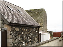 Tower-house: castle chichester in White HeadTower-house: Castle Chichester · 2.6 mi
 Muldersleigh HillMountain / peak · 3.1 mi
 Post-med Church; Medieval Parish Church; Graveyard: Templecorran Church or Temple-i-corran or Lislaynan in Forthill (ballycarry)Post-med Church · 4.7 mi
 the gobbins pathHeritage attraction · 4.7 mi
 Brompton BayBeach / strand · 5.1 mi
 Crawfordsburn Country ParkVisitor information · 5.6 mi
 Grey Point FortHeritage attraction · 5.7 mi
 Lighthouse IslandIsland · 5.7 mi
 Crawfordsburn Country ParkWood · 5.7 mi
More wrecks and historic events in County Antrim · All of County Antrim
What do you know about this place?