More pictures of this place

Places near here
Photo credits
- National Inventory of Architectural Heritage
- N Chadwick, Wikimedia Commons · CC BY-SA 2.0
- Golfing in Ireland; photographer not stated, Source publisher
- ParaDara, Wikimedia Commons · CC BY-SA 4.0
- Kiran Madhusudhanan, Wikimedia Commons · CC BY-SA 4.0
- Public picture contributor, Wikimedia Commons · CC BY-SA 3.0
- Night of the Big Wind, Wikimedia Commons · CC BY-SA 3.0 nl
- Matthew Chadwick, Geograph · CC BY-SA 2.0
- Colin Park, Wikimedia Commons · CC BY-SA 2.0
- Colin Park, Geograph · CC BY-SA 2.0
 Convent of the Sacred HeartConvent/nunnery · 215 yd
Explorer Tom Convent of the Sacred Heart in Keel East is guarding a legend about a giant who slept in the garden. The sisters…
 Achill HengeInstallation · 717 yd
Explorer Tom Achill-henge looks ancient from the wrong angle, which is exactly why I should tell you the date before inventing a…
 Achill Island Golf ClubGolf course · 1.2 mi
 Keel BeachBeach / strand · 1.4 mi
Explorer Tom Keel Beach runs for kilometres beneath Achill's mountains, with Minaun's cliffs at one end and wide Atlantic air…
 Achill Island - AcaillIsland · 1.5 mi
Explorer Tom If I say Achill is a quick detour, hide my car keys. Achill is Ireland's largest island, yet you can arrive without…
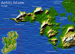 Deserted VillageHeritage attraction · 1.6 mi
Explorer Tom The Deserted Village stretches along the slopes of Slievemore on Achill, a line of roofless stone cottages that can…
 Saddle Hill Signal TowerSignal tower · 1.7 mi
Explorer Tom Saddle Hill Signal Tower is just a pile of rocks pretending to be architecture. It used to shout messages to ships, but…
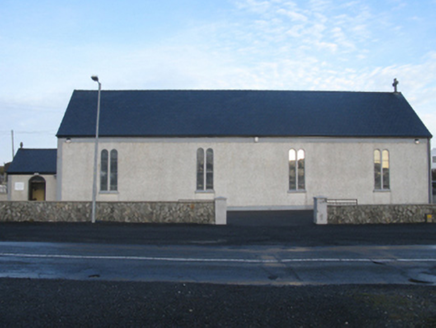 Catholic Church of Our Lady of the AssumptionChurch/chapel · 2.2 mi
Explorer Tom Our Lady of the Assumption Church in Dookinelly has a curse that only hits people who don’t wave hello. It’s reusing an…
 Crannog in DookinellyCrannog · 3.0 mi
Explorer Tom Crannog in Dookinelly is the shortcut that isn’t a shortcut because it involves wading through mud and regret. It’s an…
 Keem BeachBeach / strand · 3.9 mi
Explorer Tom Keem Beach sits at the end of an Achill road in a horseshoe bay, with steep green slopes crowding around a surprisingly…
 Moyteoge HeadMountain / peak · 4.2 mi
Explorer Tom Moyteoge Head was once used to smuggle illegal cheese across the bay in a rowboat. The customs officer never found out…
 Croaghaun sw TopMountain / peak · 4.5 mi
Explorer Tom Croaghaun sw Top was saved by a hero nobody remembers, who probably just stopped looking in the wrong direction for…
More things to do in County Mayo · All of County Mayo

What do you know about this place?Tap to add a comment or ask a question