
What is recorded here
Roadside Statue is a monument or public art in Vale of White Horse, England.
From the Geograph Britain and Ireland picture record 1704830
The picture record does not grant access. Use signed public paths and do not enter private land without permission.
Places near here
 Faringdon HouseListed building · 171 yd
 Tombs in Churchyard of All Saints ChurchListed building · 316 yd
 Monument near the market placeMonument or public art · 470 yd
 Folly HillMountain / peak · 1019 yd
 Milestone, south of FaringdonMonument or public art · 1.2 mi
 Great Coxwell BarnHeritage attraction · 1.7 mi
 Wickwood CopseWood · 1.8 mi
 Badbury HillHeritage attraction · 1.9 mi
 Badbury ClumpWood · 1.9 mi
 Battle of Radcot BridgeBattle · 2.1 mi
 ColeshillMountain / peak · 3.1 mi
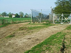 R.A.F. Bampton CastleCastle, fort or tower · 3.8 mi
Pictures: Vieve Forward, Wikimedia Commons · CC BY-SA 2.0; Bill Nicholls, Wikimedia Commons · CC BY-SA 2.0; Des Blenkinsopp, Wikimedia Commons · CC BY-SA 2.0; Brian Robert Marshall, Wikimedia Commons · CC BY-SA 2.0; Philip Halling, Wikimedia Commons · CC BY-SA 2.0; Jonathan Billinger, Wikimedia Commons · CC BY-SA 2.0; AJD, Wikimedia Commons · CC BY-SA 2.0; Unknown author Unknown author, Wikimedia Commons · Public domain; David Luther Thomas, Wikimedia Commons · CC BY-SA 2.0
More things to do in Vale of White Horse · All of Vale of White Horse
What do you know about this place?