
What is recorded here
L-plan vertically coursed dressed rubble limestone causeway, built c.1890, spanning Muckruss Strand. Dressed rubble stone sloping banks flanking carriageway. Sections of rubble stone parapets throughout having dressed limestone coping.
Crossing the Muckruss Strand this causeway is an excellent example of late nineteenth century engineering. Finely executed vertically coursed walls serve as reminders of the high skills of its builders. The north-south section of the causeway is also of importance for its contribution to an associated drainage scheme. That section of the causeway has lead to the partial reclamation of the Cloheen Strand Intake to the west.
This does not grant access. Most recorded buildings are privately owned; view them only from public ground unless the owner allows entry.
Places near here
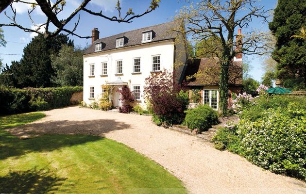 Country house in Cloheen (carbery East (e.d.) By., Kilgarriff Par.)Country house · 770 yd
 Burnt mound in Cloheen (carbery East (e.d.) By., Island Par.)Burnt mound · 906 yd
 RoadRoad, road/trackway · 973 yd
 Fulacht fia in Drombeg (ibane and Barryroe By.)Fulacht fia · 1091 yd
 Clonakilty HarbourBay · 1.1 mi
 Inchydoney BeachBeach / strand · 1.2 mi
 Clonakilty Blackpudding Visitor CentreHeritage attraction · 1.2 mi
 Cloch na gCoillteMemorial · 1.2 mi
 Clonakilty Tourist OfficeVisitor information · 1.3 mi
 CastleCastle, unclassified · 1.8 mi
 Castle Arundel (Site of)Castle, unclassified · 2.0 mi
 Stoney Beach RingBeach / strand · 2.0 mi
Other information
Photo: National Inventory of Architectural Heritage · Website use allowed for educational or private purposes with source credit