What is recorded here
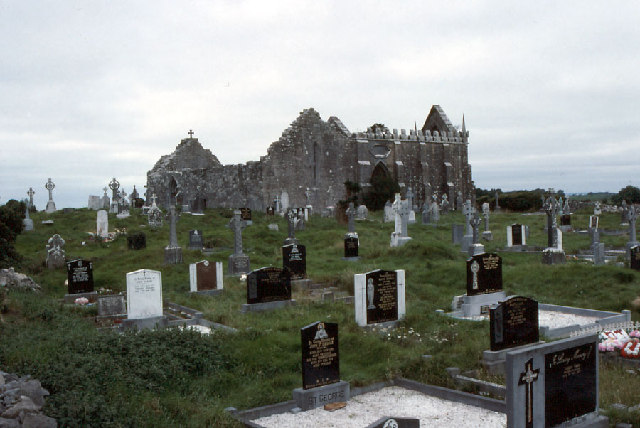
McCaffrey (1952, 81, no. 38, Fig. 9a, 193) presented a detailed plan indicating the line of a possible irregularly shaped ecclesiastical enclosure (290m ENE-WSW; 125m N-S) at the 'Monastic site' at Drumacoo. A gap at NNW may have been the original entrance. However, the 1933 edition of the OS 6-inch map indicates that the suggested line of the enclosure is, in fact, two/three roadways, which may have formerly accessed the site. The N roadway curves from roughly NW to E with a splayed gap at NNW. Only slight traces are now visible at ground level of the section running from NE to E. From NE to ENE it is defined by a slight indentation (Wth 5m; D 0.1m) and from ENE to E by the foundation lines of a wall (Wth 1.6m-1.8m; H 0.5m). Aerial reconnaissance in 1964 (CUCAP AJU 19) revealed the section from N to NE as a cropmark; otherwise no visible surface trace survives. The second road/trackway is shown on both the 1838 and 1933 map editions, extending off the previous one at ENE and curving towards the S and to the W of the church (GA103-118001-). It may also have accessed the holy well (GA103-118005-). A short section of it (L 23m; Wth 4m), running NE-SW, is visible c. 92m to the E of the church, where it is delimited by two lines of irregularly placed large limestone boulders. A bullaun stone (GA103-118007-) is visible on the S line close to the NNW-SSE running field boundary that cuts it. At its NE end it changes direction sharply and runs NW-SE.
Compiled by: Olive Alcock
Updated by: Olive Alcock
Date of revised upload: 10 February 2020
The monument record does not grant public access. Check the route and ask the landowner before entering private land.
- What survives
- Recorded monument
Places near here
 Newtown Ch.Church · 3 yd
 Drumacoomausoleum · 11 yd
 Drumacoo Monastic SiteHeritage attraction · 39 yd
 St. Sorneys WellHoly well · 53 yd
 Cross in DrumacooCross · 213 yd
 Site of Kilcolgan CastleCastle, tower house · 1.2 mi
 MweenisharanIslet · 1.5 mi
 Ballynacourty Court (in ruins)Castle, hall-house · 2.3 mi
 Fiddaun IslandIslet · 2.5 mi
 Mweenish PointHeadland · 2.7 mi
 Kilcornan ForestWood · 2.7 mi
 Loughaun WoodWood · 2.8 mi