
What is recorded here
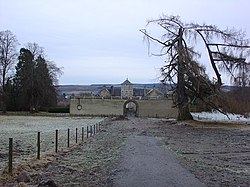
River Brora is a rig and furrow in Highland, Scotland.
From the Historic Environment Scotland record 315442
The historic-place record does not grant public access. Check current conditions and ownership before entering land or a building.
Places near here
Photo credits
- Dave Thompson, Wikimedia Commons · CC BY-SA 2.0
- Ruwan Uduwerage-Perera, Wikimedia Commons · CC BY-SA 2.0
- Andrew Tryon, Wikimedia Commons · CC BY-SA 2.0
- John Lucas, Wikimedia Commons · CC BY-SA 2.0
- Richard Webb, Wikimedia Commons · CC BY-SA 2.0
- John A Ross, Wikimedia Commons · CC BY-SA 2.0
- Alasdair MacDonald, Wikimedia Commons · CC BY-SA 2.0
- Carron K, Wikimedia Commons · CC BY-SA 2.0
 StrathbroraFindspot (21st Century), Rotary Quern · 416 yd
 AscoileCemetery (18th Century), Church (medieval) · 585 yd
 AscoileSheepfold · 617 yd
 Kilbraur BrochArchaeological place · 748 yd
 Caisteal Na CoilleCave · 2.4 mi
 Cnoc CragaidhMountain / peak · 2.5 mi
 Beinn SmeòrailMountain / peak · 2.6 mi
 BackiesCave · 4.8 mi
 Battle of Alltan-BeathBattle · 5.0 mi
 Craggie BurnNo Class (event) · 6.5 mi
 Short Sunderland dp197 Air Crash MemorialMemorial · 7.1 mi
 The Wolf StoneMemorial · 7.3 mi
More archaeology and monuments in Highland · All of Highland
What do you know about this place?