Places near here
Photo credits
- Eric Jones, Geograph · CC BY-SA 2.0
- Maker not stated on source page, www.pinterest.com
- Maker not stated on source page, www.thenorthernantiquarian.org
- Maker not stated on source page, monumentalireland.ie
- Kmcnamee, Wikimedia Commons · CC BY-SA 4.0
- Albert Bridge, Geograph · CC BY-SA 2.0
- Maker not stated on source page, commons.wikimedia.org
- Colin Park, Geograph · CC BY-SA 2.0
- Maker not stated on source page, www.dreamstime.com
- Maker not stated on source page, br.pinterest.com
 Medieval parish church (site of) & graveyard: saint john's in DromaraMedieval Parish Church (site of) & Graveyard: Saint John's · 184 yd
Explorer Tom Medieval Parish Church (site of) & GRAVEYARD: SAINT JOHN'S in Dromara is on Banbridge Road, swapping Catholic for…
 Drystone well in LevallyreaghDrystone well · 759 yd
Explorer Tom Drystone well in Levallyreagh is from the 19th century, so it's basically new to me. It thinks Dublin tourists are all…
 Cup-marked stone in BegnyCup-marked Stone · 1.1 mi
Explorer Tom Cup-marked stone in Begny is basically a prehistoric tattoo that got cold feet. Someone etched dots on it, probably to…
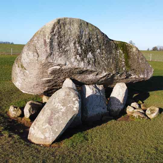 Folly: Replica portal tomb in MullaghdrinFolly: Replica portal tomb · 1.3 mi
Explorer Tom Folly: Replica portal tomb in Mullaghdrin is a modern fake pretending to be old, which is basically what every…
 Drinn Park, Dromara GAAGAA ground · 1.6 mi
 Darby's LoaninWalking route · 1.6 mi
Explorer Tom Darby's Loanin would spend its lotto win on better signposts, because right now it’s just a name. The tree-lined banks…
 Enclosure in DrinEnclosure · 1.8 mi
Explorer Tom Enclosure in Drin is where a poet fell in a ditch and wrote a sonnet about the mud. It was terrible, but he loved it.…
 Pass LoaningWalking route · 2.3 mi
Explorer Tom Pass Loaning refuses to fall down because it’s got a secret deal with gravity that nobody else seems to understand yet.…
 Enclosure in DrumkeeraghEnclosure · 3.4 mi
Explorer Tom Enclosure in Drumkeeragh has no idea when it was built, which is very rude for a landmark. It’s basically a mystery box…
 Drumkeeragh Forest ParkPark · 3.6 mi
Explorer Tom Drumkeeragh Forest Park in County Down would teach history class if forced, but it would mostly complain about how many…
 Finnis Man-made underground passageArchaeological place · 3.6 mi
Explorer Tom Finnis Man-made underground passage has an escape plan that involves crawling under a rock and hoping nobody notices…
 Dromore New CemeteryCemetery · 5.2 mi
Explorer Tom Dromore New Cemetery would be exactly where Saint Patrick went to hide from all the snakes, except there were no…
More viewpoints and information in County Down · All of County Down

What do you know about this place?Tap to add a comment or ask a question