What is recorded here
Four metres of collapsed church stone buried the Lower Monks' Garden, hiding a clochan that lighthouse builders occupied during the 1820s before the ruin fell upon it. The garden swallowed its own history under a blanket of debris, waiting for shovels to pull the breath back out. What looked like two separate terraces was one forgotten room, crushed and breathing again only when the weight was lifted.
This is known as the Lower Monks' Garden. Prior to excavation it consisted of two abutting terraces separated by a 19th century wall. The NE terrace is noted in O'Sullivan and Sheehan as a separate 'small poorly preserved terrace' (1996, 286 (20)). Excavation and conservation work in this area have demonstrated that this NE terrace was not separate but originally formed part of the Lower Monks' Garden. They revealed traces of a short NE-SW stretch of stepping stones, as well as the remains of a clochán (KE104A001066-), an enclosure (KE104A001029-) and a smaller terrace (KE104A001110-) with a platform (KE104A001020-) on top (pers. comm. G. Rourke, E. Bourke; Bourke 1994, 45; 1995, 44-5).
Excavations in 1994 on this terrace were summarised as follows; 'Excavation in advance of conservation works took place over a fourteen week period between May and August 1994. The work concentrated on the Lower Monks' Garden. A large area at the eastern end of the garden was opened to facilitate conservation and reconstruction of the outer wall of the terrace. Excavation revealed that there was up to 4.5m of 19th-century collapse over this end of the garden. Much of this debris dates to the collapse of part of Saint Michael's church [KE104A001042-] and the inner wall of the garden. The weight of this debris seems to have resulted in the collapse of the eastern end of the outer wall of the garden and some loss of the stratigraphy against the inner edge of the outer wall.
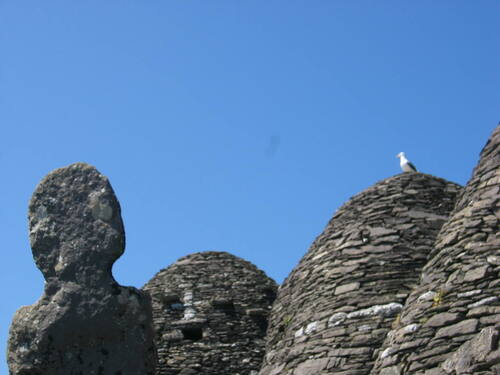
At the base of the cutting a large clochán [KE104A001066-] and an area of stone paving was uncovered. This clochán was occupied by the lighthouse builders in the 1820s and was destroyed by the collapse. There were traces of an earlier building in the section face at the outer edge of the garden but this could not be investigated as it underlay the paving associated with the clochán' (Bourke 1995, 44-5)
Compiled by: Elizabeth Byrne, Ursula Egan and Sheila Ronan, Archaeological Survey Unit, University College, Cork.
Revised by: Caimin O'Brien
Date of revised upload: 11 March 2022
This remains an important historical record, but the official description says the monument is no longer visible or has been destroyed. The monument record does not grant public access. Check the route and ask the landowner before entering private land.
- What survives
- No visible remains or recorded as destroyed
Places near here
 Skellig MonasteryHeritage attraction · 11 yd
 Church (in Ruins)Church · 16 yd
 North PeakMountain / peak · 62 yd
 Cross in Sceilg MhichílCross · 108 yd
 Sceilig MhichílIslet · 155 yd
 Enclosure in Sceilg MhichílEnclosure · 186 yd
 Church in Sceilg MhichílChurch · 244 yd
 Sceilg MhíchílMountain / peak · 265 yd
 Pointe na bhFaoileannHeadland · 381 yd
 Sceilig BheagIslet · 1.5 mi
 LéimeHeadland · 6.8 mi
 Tráigh na SplinceBeach / strand · 8.6 mi