What is recorded here
Indicated is a levelled fairy fort in flat Limerick pasture, its circular bank reduced to a low scarp and shallow fosse beside a wandering stream. It appeared on an 1840 map, vanished from a later one, and still shows in aerial images as a faint ring where field boundaries and relic enclosures press against it. The forges may have swallowed its name, but the land kept the shape, waiting for someone to walk the rim and remember what the forges forgot.
In flat pasture abutting the townland boundary with Coolybrown. Located 290m SE of a ringfort (LI028-058----). The site is depicted as a circular enclosure on the 1840 ed. OSi 6-inch map. Not shown on the 1897 ed. OSi 25-inch map. The site is visible on the OSi orthoimage taken 2005-12 and on Digital Globe orthoimages taken 2011-2013. Monument inspected by the ASI in 2007 and described as consisting of a roughly circular area (dims. 20m NE-SW; 18m NW-SE) defined by remains of levelled bank reduced to scarp (Wth 4.5m; H 0.4m) and shallow fosse (basal Wth 1m; overall Wth 7.5m; D 0.15m) truncated by a stream and field boundary from N-NE. Interior level and incorporated into rest of field as pasture. Sinuous gullies around exterior of monument caused by overflow from stream. A series of relic field enclosures (ext. dims. c. 27m N-S; 34m E-W) abut the SSE side of the enclosure and are visible on the aerial orthoimages. The monument is visible on the Google Earth orthoimage taken 29/03/2012 and 08/04/2015.
See attached ASI sketch plan, photographs and Google Earth orthoimages
Compiled by: Edmond O’Donovan
Date of upload: 24 September 2020
The monument record does not grant public access. Check the route and ask the landowner before entering private land.
- What survives
- Recorded monument
Places near here
 Elm Hillcountry house · 648 yd
 Grave YardGraveyard · 922 yd
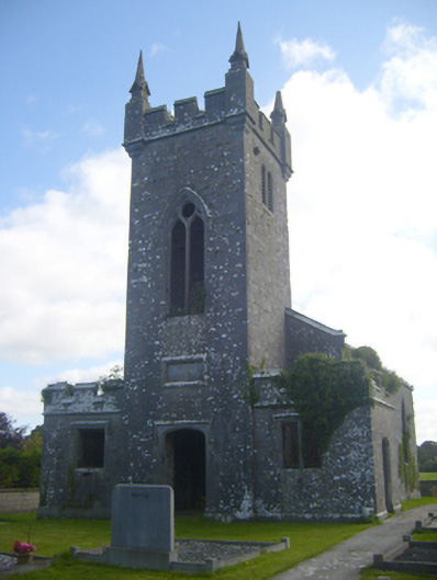 Kilscannell Churchchurch/chapel · 930 yd
 St. Kieran's WellSpring · 1300 yd
 St. Kierans WellHoly well · 1307 yd
 St. Luke's WellSpring · 1.2 mi
 CahermoyleCastle, unclassified · 1.4 mi
 Bawn in Lisnacullia (connello Lower By.)Bawn · 1.7 mi
 European ashEuropean ash · 2.9 mi
 Limerick GreenwayWalking route · 6.3 mi
 Sugar HillMountain / peak · 7.9 mi
 Gammarel PointHeadland · 8.5 mi