What is recorded here
Half a metre of grey stone stands at the graveyard's edge, small enough to lift yet heavy with age. Its cross breaks the circle's boundary, as if refusing to be contained. Monks may have laid their dead beside it, or it may have marked the place where they first stopped walking. Either way, the line carved through the circle suggests belief itself was spilling outward.
Cross-slab described in 1996 as follows; 'Standing close to the NE edge of the Monks' Graveyard [KE104A001046-], this slab is of regular rectangular elevation. It features an encircled cross, the lower shaft of which extends outside the circle, on its W face; H: 0.45m W: 0.29m T: 0.07m' (O'Sullivan and Sheehan 1996, 289, no. 948 (67)).
See attached drawing of cross taken from The Iveragh peninsula: an archaeological survey of South Kerry'. Cork University Press (1996) Fig. 180.
The above description is derived from A. O'Sullivan and J. Sheehan (compilers), 'The Iveragh peninsula: an archaeological survey of South Kerry'. Cork University Press (1996), no. 948. In certain instances the entries have been revised and updated in the light of recent research.
Revised by: Caimin O'Brien
Date of revised upload: 10 March 2022
Dateable to the early medieval period, likely between the 8th and 11th centuries, the cross-slab reflects Christian symbolism associated with monastic sites. Such stones often served as memorials, markers, or devotional objects within monastic cemeteries.
The monument record does not grant public access. Check the route and ask the landowner before entering private land.
- What survives
- Recorded monument
Places near here
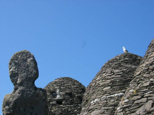 Church (in Ruins)Church · 16 yd
 Skellig MonasteryHeritage attraction · 33 yd
 North PeakMountain / peak · 62 yd
 Cross in Sceilg MhichílCross · 93 yd
 Sceilig MhichílIslet · 175 yd
 Enclosure in Sceilg MhichílEnclosure · 214 yd
 Church in Sceilg MhichílChurch · 263 yd
 Sceilg MhíchílMountain / peak · 286 yd
 Pointe na bhFaoileannHeadland · 354 yd
 Sceilig BheagIslet · 1.5 mi
 LéimeHeadland · 6.8 mi
 Tráigh na SplinceBeach / strand · 8.5 mi