What is recorded here
Indicated is a fairy fort on the highest point of a Mayo ridge, where the earth rises into a broad oval platform and drops sharply toward forested ground. Its scarp merges with the natural slope, creating a boundary that seems drawn rather than built, while a narrow gap at the west hints at an entrance never formally made. The site still holds breath, visibility and risk, inviting people to imagine what lived there before human tools shaped it.
Located at the highest point on an E-W ridge, providing extensive views over the surrounding landscape. The fall of ground is pronounced to S, but there is a more gradual slope to N. Forestry is planted in the immediate surrounds to S, W and N; there is pasture to E.
Broadly oval raised area or platform (28.4m NW-SE; c. 22m NE-SW) defined by a scarp. The rath spans the full width of the ridge top, so that the enclosing scarp at N and S merges with and is enhanced by the steep natural fall of ground. At E the scarp is slightly truncated by a roughly NW−SE field fence. Another field fence skirts the base of the scarp at NW−N, respecting its curve.
The SE quadrant of the interior is noticeably higher than the rest of the interior, with a gently slope down from there to W, and a more pronounced slope down to N. There is a low area (Wth 2.7m) in the scarp at WNW which may mark an entrance.
The interior is covered in rough grass, with clumps of gorse, heather, brambles and blackthorn; hawthorn and blackthorn ring the perimeter, especially dense at E where the field fence intersects the rath scarp.
Another rath (MA062-052001-) is located c. 140m to E, at the E edge of the same ridge. There are a church (MA-062-047001-) and graveyard (MA062-047002-) c. 145m to NW, and an enclosure (MA062-048) c. 60m to N.
Compiled by: Jane O’Shaughnessy
Date of upload: 30 November 2020
The monument record does not grant public access. Check the route and ask the landowner before entering private land.
- What survives
- Recorded monument
Places near here
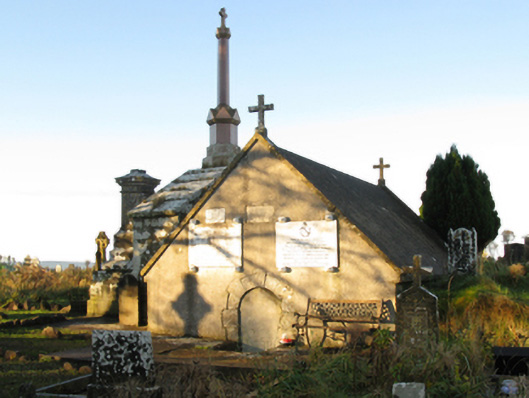 mausoleummausoleum · 264 yd
 bridgebridge · 516 yd
 Procession Of The SoulsMemorial · 737 yd
 IndicatedFairy fort / earthen ringfort · 1116 yd
 Brabazon WoodsForest · 1118 yd
 ToberbrideHoly well · 1360 yd
 Youth Memorial GardenMemorial · 1430 yd
 HawthornHawthorn · 2.4 mi
 Castle (in Ruins)Castle, unclassified · 2.7 mi
 Hennigan's Heritage CentreHeritage attraction · 2.8 mi
 Thorn CaveCave · 4.0 mi
 Kiltimagh MuseumMuseum · 7.3 mi