
What is recorded here
Indicated is a partially buried fairy fort on a wooded ridge above Swinford, its twenty-five-metre circle reduced to a faint earth scar and scattered stones. The south-western bank still rises sharply where human leveling stopped, while the northern edge dissolves into overgrowth and shadow. It is the kind of place that resists memory, presenting itself as an ordinary hollow until dusk reveals the hidden shape beneath the trees.
On the E outskirts of Swinford town, located just below the summit of an E–W ridge. The ridge is cloaked in woodland.
This enclosure has been partly levelled. It is evident as a circular area (diam. c. 25m) defined by remnants of a bank/scarp. At S–SW the scarp (H 1.6m) remains quite pronounced where it merges with a natural fall of ground, but elsewhere the enclosing bank is reduced to a slight rise or undulation, from which stones protrude in parts. On the N arc there is a slight inward-facing scarp. The interior is not raised, and appears slightly sunken on the N arc. It is planted with trees and obscured by overgrowth.
Compiled by: Jane O’Shaughnessy
Date of upload: 7 December 2020
The monument record does not grant public access. Check the route and ask the landowner before entering private land.
- What survives
- Recorded monument
Places near here
 Brabazon WoodsForest · 91 yd
 handball alleyhandball alley · 279 yd
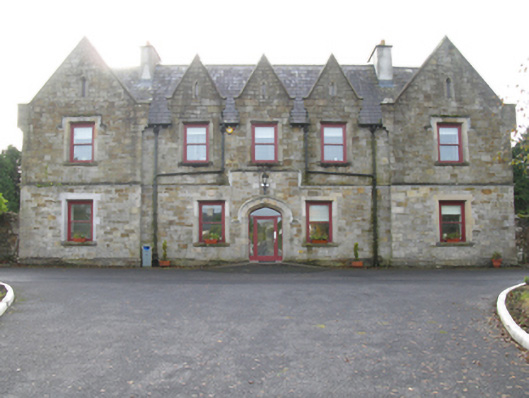 Swinford Union Workhouseworkhouse · 330 yd
 ToberbrideHoly well · 463 yd
 Procession Of The SoulsMemorial · 551 yd
 Youth Memorial GardenMemorial · 724 yd
 Enclosure in NewparkEnclosure · 1168 yd
 HawthornHawthorn · 2.5 mi
 Castle (in Ruins)Castle, unclassified · 2.8 mi
 Hennigan's Heritage CentreHeritage attraction · 2.9 mi
 Thorn CaveCave · 3.3 mi
 Kiltimagh MuseumMuseum · 6.7 mi
Other information
Photo: Credit not shown in the picture search · Rights wording not checked; contact us if this picture should be removed