What is recorded here
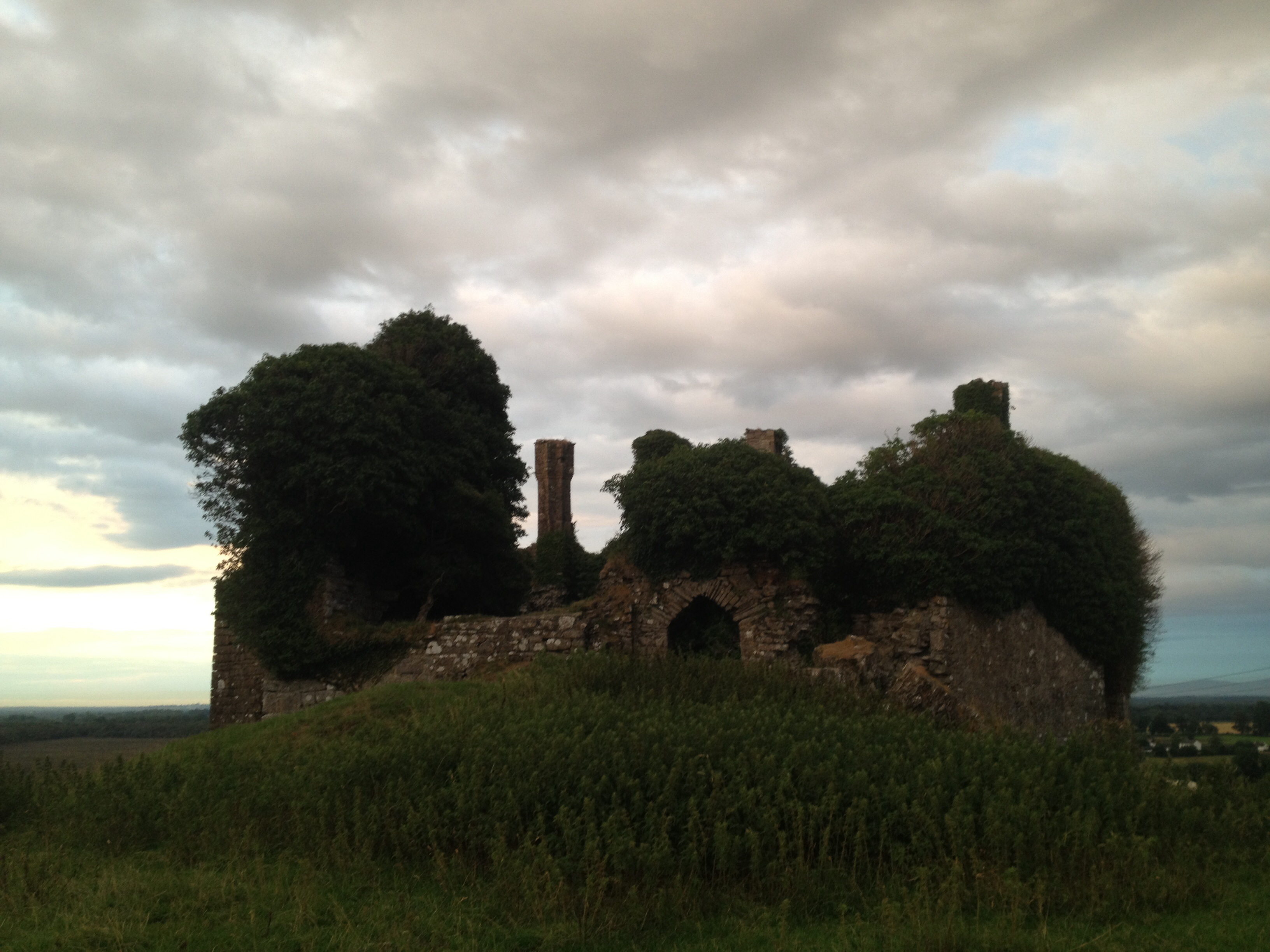
Enclosure in Rathasker stands on a Kildare hilltop where a castle once rose inside a circular earthen fort. The fort measured forty metres across, bounded by a bank and outside ditch, with gaps at north and east. People may have lived beneath that castle before the stones fell, but no name or date survives to confirm it. In 1984 the visible remains were levelled, leaving only faint traces beneath the pasture.
On a hilltop (OD 423 feet) in pasture. In 1837 according to the OSL (Herity 2002, 59 (173)), ‘In Rathascar T.L. are the ruins of a castle [KD024-001002-] standing in the centre of a Fort or Mound.’ A circular area (diam 40m) was enclosed by an earthen bank, gapped at N and E, and an external fosse. The interior contained the foundations of a castle (KD024-001002-), probably a tower house (SMR file). The monuments were levelled in 1984, but subsurface remains may survive.
Compiled by: Gearóid Conroy
Date of upload: 07 June 2012
This monument is subject to a preservation order made under the National Monuments Acts 1930 to 2014 (PO no. 9/1971).
The monument record does not grant public access. Check the route and ask the landowner before entering private land.
- What survives
- Recorded monument
Places near here
 CastleCastle, unclassified · 2 yd
 Enclosure in BluebellEnclosure · 782 yd
 Church in Killashee (killashee Ed)Church · 1515 yd
 Site of CastleCastle, unclassified · 1538 yd
 St Patricks WellHoly well · 1.0 mi
 Limerick Bridgebridge · 1.0 mi
 European Crab AppleEuropean Crab Apple · 1.6 mi
 Poplar SquarePicnic place · 1.9 mi
 Monread District Park WoodsWood · 2.7 mi
 Newbridge SilverwareMuseum · 4.8 mi
 Cupidstown HillMountain / peak · 8.2 mi
 OldcourtMemorial · 9.1 mi