What is recorded here
Fairy fort / earthen ringfort in Montore is a fairy fort or earthen ringfort in Montore, County Tipperary, Ireland. The site occupies a roughly circular area 31 metres north-south and 28 metres east-west on a fairly steep southwest slope. An earth and stone bank defines the enclosure, standing 1.41 metres high externally and 0.17 metres high internally. The bank has been levelled in the north and east sectors, where it broadens to 4 metres and drops to 0.38 metres external height.
Situated on a fairly steep SW slope, in rolling pastureland with a ringfort (TN023-009) and possible ringfort (TN023-010) to the SSW and S respectively. A roughly circular area (dims. 31m N-S; 28m E-W) defined by an earth and stone bank (Wth 1m; int. H 0.17m; ext. H 1.41m). In the N and E sectors the bank has been levelled (Wth 4m; int. H 0.2m; ext. 0.38m). No trace of a fosse or entrance feature.
The above description is derived from 'The Archaeological Inventory of County Tipperary. Vol. 1 - North Tipperary' compiled by Jean Farrelly and Caimin O'Brien (Dublin: Stationery Office, 2002). In certain instances the entries have been revised and updated in the light of recent research.
Date of upload/revision: 22 September 2008
The monument record does not grant public access. Check the route and ask the landowner before entering private land.
- What survives
- Recorded monument
Places near here
 Enclosure in Longford WoodEnclosure · 564 yd
 Hollywell Millmill (water) · 1062 yd
 Holly WellHoly well · 1254 yd
 Longford WoodForest · 1479 yd
 OutlinedCastle, Anglo-Norman masonry castle · 1.1 mi
 Castle (in ruins)Castle, tower house · 1.4 mi
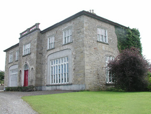 Lisduff Housecountry house · 1.7 mi
 BenduffMountain / peak · 2.9 mi
 Borrisnoe MountainMountain / peak · 3.7 mi
 Roscrea Petty Sessions HouseHeritage attraction · 5.4 mi
 European ashEuropean ash · 5.8 mi
 Thomas MacDonagh Heritage CentreMuseum · 8.2 mi